8. CASE EXAMPLES OF SYNERGIES IN POLICY MEASURES
In order to shed light on how the Nordic countries have been successful in implementing measures to simultaneously address climate change, pollution and biodiversity objectives in laws, policies and administrative practices, three cases from each of the Nordic countries (Sweden, Norway, Denmark, Iceland and Finland) are presented. The cases address different policy solutions and different types of NbS.
Continuous Cover Forestry Provides Opportunities to Integrate Environmental Concerns in Production Forests in Sweden
Forests cover 70% of Sweden's land area. As the forests sequester carbon, they are crucial for mitigating climate change. At the same time, forests provide an important habitat for Sweden’s native species. Since about 90% of the productive forest area in Sweden is managed for timber production,
Felton (2016)
Close-to-nature forest management methods such as continuous cover forestry provide opportunities to integrate environmental concerns in production forests.
Eyvindson et al. (2021); Nordlund & Westin (2011)
SFA (2021a)
SFA (2021a)
SFA (2010)
Continuous cover forestry enables structural complexity
Many forest species depend on the continuity of the forest, which is interrupted when the forest is cleared. With continuous cover forestry, the forest is continuously covered with trees, maintaining microclimatic conditions, and benefiting species tied to this habitat type. An uneven-aged, heterogeneous forest structure is created which improves the overall structural complexity of the forest and mimics natural forests and natural disturbance regime.
Felton et al. (2020)
SFA (2017)
SLU (2017)
Types of continuous cover forestry
CCF includes several methods, depending on the forest species. For Norway, spruce-dominated forests ‘Blädning’ is a suitable method due to the low light requirement of the species. Through this method, an uneven-aged forest structure is created, and the felling takes place every 10–30 years focusing on the largest trees. ‘Luckhuggning’ (gap cutting) is a method that can be applied in spruce and beech forests, but attempts are also made in pine forests. It involves the creation of small gaps of a maximum size of 0.25 hectares. The size of the gaps depends on the type of forest and the amount of light that is to reach the ground. The larger the gaps, the greater the possibility of regenerating light-demanding tree species such as pine and deciduous trees. In the gaps, small trees and plants can be left, together with individual storm-resistant trees. The rejuvenation of trees in the gaps creates an uneven forest stand. Rejuvenating a stand using ‘luckhuggning’, takes about 3–4 cuts or 20–30 years. A variant of ‘luckhuggning’ is ‘Schackrutehuggning‘. This measure is still at the experimental level and includes the division of the forest into a grid pattern which is then felled in two or more stages. A method that can be used for tree species that need more light to grow such as Scots pine is called ‘överhållen skärm’. Under the canopy of large trees, a stand of young trees is cultivated either through natural seeding or planting. Once the new stand has grown (at least 2.5 meters of height), the mature trees can be gradually felled. However, to be considered as CCF, at least 25 of the mature trees per hectare need to be left.
SFA (2021b)
The Swedish Forest Agency’s policy focusing on increased application of CCF is in line with the EU Forestry Strategy (COM (2021) 572 final), which also highlights the importance of management practices that support biodiversity and resilience. The policy can also be linked to the Swedish forestry Act giving environmental and production goals equal weight (SFS 1993:553) and the environmental quality objectives ‘Living forests’.
SFA (2022)
Continuous cover forestry supports multifunctionality of forests
Forest management systems have been evaluated in 2017, but without a specific focus on synergies. Their evaluation shows that both ecological theories and empirical studies point towards higher benefits of late successional species from CCF than from rotation forestry. Regarding carbon balances, the evaluation is more uncertain, as climate benefits depend on the time scale, the interplay between forest management, carbon storage in forests and carbon storage in forest products, and the substitution effect of fossil fuels.
SLU (2017)
Peura et al. (2018); SFA (2021b)
SFA (2021b)
In addition to that, studies have shown that CCF supports forest multifunctionality better than rotation forestry.
Peura et al. (2018)
SLU (2017)
Pukkala et al. (2011); Pukkala et al. (2016)
Öhrn et al. (2021); Vulturius et al. (2020)
Pukkala et al. (2016); Zubizarreta-Gerendiain et al. (2012)
Linköping Municipality: A pioneer in continuous cover forestry
Forest management in Sweden is regulated by soft laws. While rotation forestry is still the predominant forest management method,
SLU (2017)
Linköpings kommun (2020)
Protecting Pristine Wetlands – Eyjabakkar Wetlands in Iceland
Wetland conservation and restoration are nature-based solutions for mitigating climate change. Wetlands sequester carbon, are rich in biodiversity, and when drained they emit large amounts of greenhouse gases. Most of the Icelandic wetlands have been destroyed or damaged up to this date. There are numerous efforts to restore degraded wetlands, and restoration of wetlands are an important part of Iceland’s climate action plan. However, the conservation of the remaining wetlands is also of vital importance. Not only does it benefit other restoration projects, biodiversity and carbon sequestration are also generally higher in undisturbed wetlands compared to restored ones.
The importance of Icelandic wetlands
Wetlands are important ecosystems, providing a wide range of important ecosystem services such as carbon sequestration, water quality and biodiversity. In Iceland, wetlands are important bird habitats.
The Icelandic wetlands were mainly undisturbed until the mid-19th century, but in the 20th century, especially in the latter part, wetlands were drained for agricultural purposes at a grand scale.
SCSI (2022)
Institute of Economic Studies (2009)
Arnalds O., et al. (2016)
The Icelandic Wetland Fund (2022)
Government of Iceland (2021)
It is estimated that 60,000 ha of drained wetlands currently are used for agriculture. But with increased will to bring back healthy wetland ecosystems, the Ministry of the Environment, Energy and Climate estimates that it is technically possible to restore 90,000 ha of previously drained wetland.
Ministry for the Environment and Natural Resources. (2018)
The first wetland restoration attempts were initiated by bird conservation enthusiasts in the late 1990s, and the first committee to address the possibility for wetland reclamation was formed in 1996 by the then agricultural and environmental minister.
Ármannsdóttir, H. Þ. (2022)
Climate Change
Wetland restoration and conservation are effective measures to decrease greenhouse gas emissions, sequestering carbon and simultaneously providing other benefits such as improved water quality and biodiversity. In the Icelandic Climate Action Plan for 2018–2030, several of the mitigation measures within land use, land-use change, and forestry focuses on wetlands:
Government of Iceland (2020)
IPCC Guidelines (2014)
- 20. Strengthened protection of wetlands: “Efforts will be made to ensure the protection of wetlands, as drained wetlands are a source of carbon dioxide emissions. Monitoring of wetland drainage will be improved, and regulations reviewed, inter alia to investigate setting requirements of wetland rehabilitation to compensate for draining activities.”
- 21. Restoration of drained wetlands: “A plan for wetland restoration will be made and funded, in order to reduce emissions from drained wetlands, as well as restoring natural habitats”
In the period between 1990–2015, the LULUCF sector had the highest net emissions on Iceland. A large part of the absolute value of emissions from the sector was from cropland and grassland on drained organic soil. The emissions can be attributed to drainage of wetlands in the latter half of the 20th century, a practice that largely ceased by 1990. Emissions of CO2 from drained wetlands continue for years after drainage.
Ministry for the Environment and Natural Resources. (2018)
Ármannsdóttir, H. Þ. (2022)
Wetlands Conservation
The Soil Conservation Service and Environment Agency of Iceland are responsible for putting new policies and measures forward. The types of instruments, the Icelandic Government announced to apply to achieve better wetland conservation, are fiscal, planning and regulatory policies and measures.
Ministry of the Environment, Energy and Climate (2022)
Restoration or conservation
Restoration is a complex undertaking. Evaluations of completed restoration projects often show less than desired results for a wide range of parameters such as native biodiversity, water quality and carbon sequestration even decades after completion.
Palmer & Stewart (2020)
Baumane et al. (2021)
Meli et al. (2014)
The complexity of restoration emphasizes the importance of protecting and conserving unspoiled nature. When first degraded, it is difficult to re-establish a site to pre-degraded conditions. Climate mitigation benefits are generally higher in natural ecosystems, since disturbed ecosystems are more vulnerable and more readily release carbon.
Cook-Patton et al. (2021)
Mokany et al. (2020)
Eyjabakkar - the second-largest wetland in Iceland
Eyjabakkar is in the East highlands of Iceland. It has some of the most diverse vegetation in the Icelandic highlands, and the wetland is an important bird habitat with many different species.
Baldursson et al. (2018)
Ministry for the Environment and Natural Resources & Ministry of Education, Science and Culture (2013)
Government of Iceland (2022)
IUCN (2022)
The Ramsar Convention
The convention on Wetlands, adopted in 1971, is an intergovernmental treaty providing a framework for the conservation and wise use of wetlands and their resources.
Iceland currently has six Ramsar Sites.
The risk of adding damage elsewhere
When the plans to irrigate Eyjabakkar were dismissed, the glacier river Jokulsa was dammed instead. This illustrates the complexities of accommodating multiple interests and policy goals simultaneously.
Guide to Iceland (2022)
Environmental Justice Atlas (2022)
Government of Iceland (2022)
Voegeli & Finger (2021)
From National Pollinator Strategy to Local Pollinator Project in Norway
The creation of pollinator habitats benefits biodiversity, carbon sequestration,
Kyrkjeeide et al. (2020)
Every four years, the Norwegian Government publishes national expectations regarding regional and municipal planning.
Ministry of Local Government and Modernisation (2019)
Ministry of Local Government and regional development (2008) This follows from section 6-1 of the Norwegian Planning and Building Act
In the 2019 governmental expectations it is stated that: “Preservation of habitats for wild pollinator insects is important for ecosystems and for pollination of agricultural crops. The government attaches great importance to safeguarding threatened nature, and that ecosystems are maintained in good condition. The municipalities have a particularly weighty responsibility to contribute to this in their planning, including by protecting selected types of habitats pursuant to the Nature Diversity Act.”
Linking the strategy to local activities
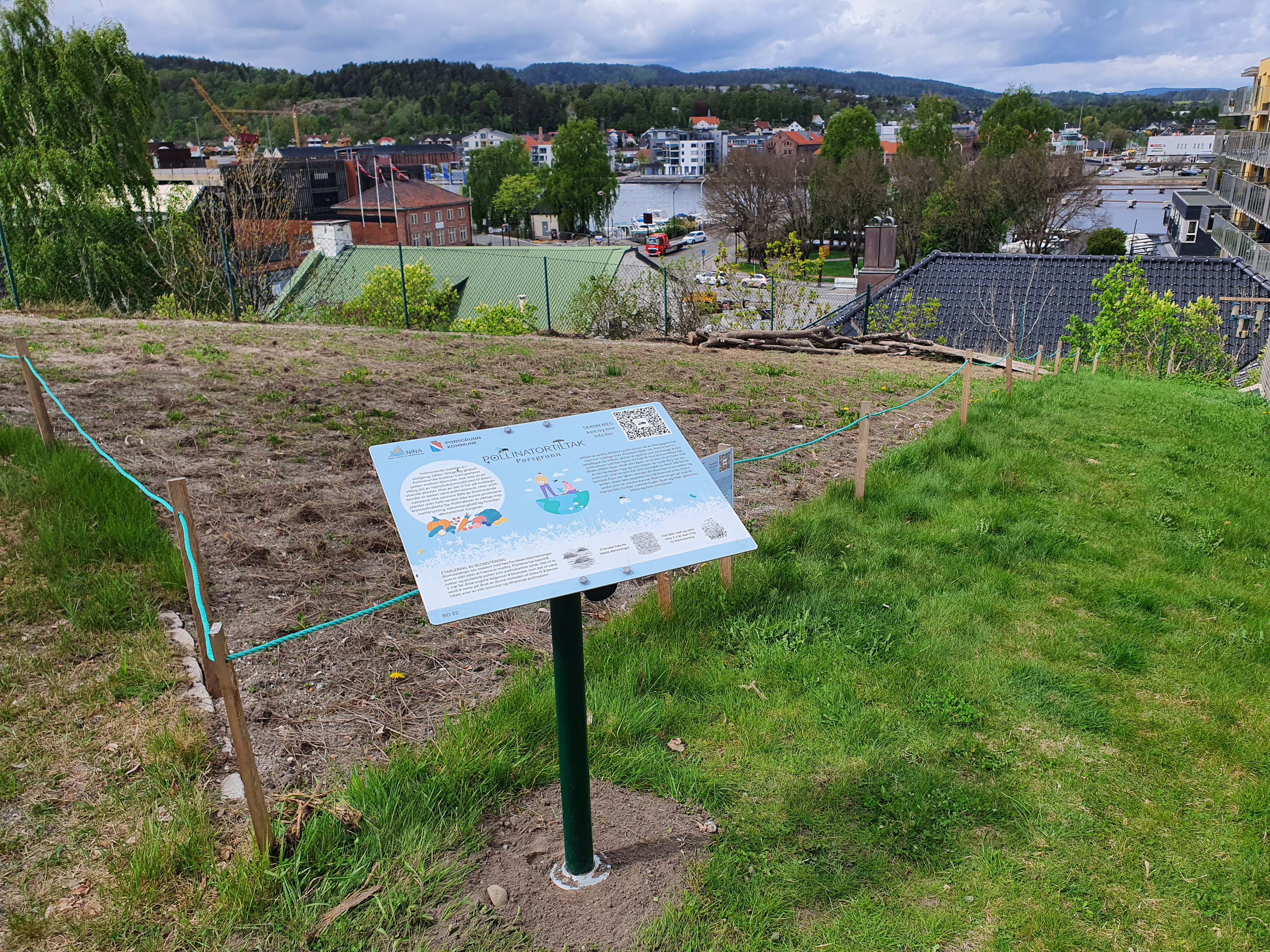
Porsgrunn Municipal Council (Porsgrunn Kommune) situated in the south of Norway is taking action for pollinators by planning and creating flower meadows and other pollinator habitats in municipal parks. Moreover, maps showing priority areas for pollinator actions in Porsgrunn’s municipal plans were developed.
Pollinatortiltak Porsgrunn (2022)
The Porsgrunn Pollinator Project shows how local and municipal actions can be integral to achieving the National Pollinator Strategy of 2018 by creating and restoring habitats for pollinators and improving green spaces in the city. The National Pollinator Strategy has three of goals, i) increased knowledge, ii) establishing habitats and iii) communication), and the local project in Porsgrunn addresses all three. The project can be viewed as a response to the county climate action program (Klimahandlingsplan), which states that measures to protect pollinators must be taken.
Using data and spatial analyses to ensure maximum effect
The Porsgrunn Municipal County instigated the Porsgrunn Pollinator project in collaboration between local politicians, the municipality and the Norwegian Institute for Nature Research (NINA). The role of NINA was to create habitats in three locations that consisted of both floral resources and nesting sites for pollinators. The locations were chosen in order to increase the number of wild bees and other pollinators as well as to protect local species of wildflowers. Furthermore, NINA provided maps and advised on further targeted measures to prioritize in the surrounding areas.
The creation of maps showing priority areas for pollinator actions is a key aspect of integrating knowledge on biodiversity into Porsgrunn’s municipal plans, thereby meeting the requirement for effective and informed local planning. Many types of pollinators require both floral resources and nesting sites within a certain radius and if the spatial location of pollinator interventions are not considered, then they are not useful. This project used spatial analysis in GIS to determine exactly what type of interventions were needed and where to create them to have the biggest impact.
Synergies between benefitting biodiversity and storing carbon
The creation of pollinator habitats is a significant effect of the national strategy. It will benefit biodiversity, but also has positive benefits for carbon sequestration,
Kyrkjeeide et al. (2020)
Implementation of national pollinator strategies through local planning and projects such as the Porsgrunn Pollinator Project addresses the need for more pollinator habitats by also promoting the management and restoration of critically endangered hay meadows. These traditional hay meadows have a very high diversity of both plants and wildlife; however, without a use or market for the hay, most have been abandoned. The Norwegian Institute for Nature Research has shown that hay from local hay meadows (referred to as donor meadows) can be used to establish new flower meadows, providing an incentive for better management. Over the following three years, seeds from the hay will germinate and grow into new flower meadows, which will be a very important resource for pollinators, whose populations are declining rapidly both in Norway and globally. Semi-natural meadow conservation and management is highly topical in Europe and the experience of the project will add to the growing body of research on developing protocols and guidelines.
A case of multi-level governance
When measures benefitting both biodiversity and climate mitigation can take form from a national pollinator strategy to local pollinator project, a true example of multi-level governance is seen. It is stated in the national strategy that “municipal authorities should give consideration to pollinator-friendly development and administration of municipal green infrastructure”, and this is exactly what has been carried through in Porsgrunn Municipality. By bringing flower meadows into urban environments, new foraging resources for pollinators, habitats for birds and small mammals, and a renewable and sustainable source that conserves the local gene pool of flowering plants, has been established, while enhancing carbon sequestration. Meanwhile, hay meadow management has been supported and new markets for this species-rich hay has been created.
Subsidies for Lowland Soil Projects in Denmark
The Danish Government is offering subsidies to cease agricultural production on lowland soils with high organic content. The measure offers a joint solution for mitigating greenhouse gas emissions, nutrient pollution, and biodiversity loss. While experts agree that rewetting lowland soils is positive for climate and nature, it is difficult to foresee the specific climate and biodiversity effects, which will probably be highly dependent on the individual area characteristics.
Tackling eutrophication, greenhouse gas emissions and uniform landscapes
Eutrophication of coastal water and lakes is one of the great environmental problems in Denmark. The problem mainly stems from the country’s intensive agricultural production, in which large amounts of fertilizer are applied to soils and then leach into water bodies. To address this issue, the Danish Government has been focusing on measures that contribute to reduced nutrient emissions to fjords and coastal waters, while combining this with reduced greenhouse gas emissions and increasing nature quality. Abandoning agricultural production on carbon rich lowland soils is one practice that can remedy all three challenges, and this has been promoted by the Danish Government. The specific policy instruments used are subsidies for converting intensively cultivated agricultural soils to land for extensive production methods. Counting the subsidies and other measures with the purpose of rewetting agricultural land, the Government plans to take a total of 88.500 ha of lowland soils out of production.
Selected criteria to receive subsidies to establish lowland projects
- The project is located in a watershed area where a lowland project is expected to bring nitrogen reductions of minimum 30 kg nitrogen/ha/year.
- The project entails a shift to extensive agriculture contributing to a reduction of greenhouse gases corresponding to a minimum of 10 tons CO2 equivalents/ha /year.
- The project supports natural hydrology in the area.
- The project is not expected to contribute to increase phosphorous emissions that have a negative effect on the environment.
- The project should be cost efficient.
- The project contributes to increasing nature quality and the creation of coherent, robust nature areas.
Funding is granted from the European Agricultural Fund for Rural Development and nationally from the Ministry of Food, Agriculture and Fisheries.
Danish Agricultural Agency (2022)
Danish Agricultural Agency (2022)
In the period between 2014 and 2018, the Agricultural Agency examined 81 subsidy applications, out of which 13 projects were realised.
SEGES (2019)
Climate opportunities of organic soils
In Denmark, it is estimated that 170.000 ha of carbon rich lowland soils are in use in intensive agricultural production, corresponding to 7% of the total agricultural land.
The Danish Climate Council (2020)
The Danish Climate Council (2020)
Lowland soils in Denmark have been drained at a large scale since the 19th century, and greenhouse gas emissions have as a consequence been ongoing for the past hundred to two hundred years.
REAS (2022)
Danish Environmental Agency (2022)
Uncertain climate results of rewetting
There are ongoing scientific discussions of the climate effect of rewetting agricultural soils. The assumption behind rewetting measures is that the lowland areas will stop emitting or, ideally, start sequestering CO2. Researchers are however pointing to the fact that the restored wet areas are different to natural wetland areas in several ways.
REAS (2022)
Emsens et al (2020)
Hemes et al. (2019)
In order to ensure that they act as a climate benefit it may be necessary to have more active management of the restored areas to support the natural flora and fauna, hydrology and microbial processes.
Rewetting for nutrient retention and biodiversity
Draining of agricultural soils and subsequent continuous adding of fertiliser have contributed to nutrient pollution of Danish lakes and coastal waters. Drainpipes provide a fast track where nutrients that are brought with the water quickly get transported to water bodies and the sea where they cause ecological issues through eutrophication and oxygen depletion. By blocking draining routes, the nutrient rich water is instead filtered through the soil where nutrients are held back. Stopping intensive agricultural production on the land will also mean a halt to fertilizer addition in these areas, decreasing the risk for airborne ammonia pollution which is known to have consequences such as eutrophication of soil and water bodies as well as increased acid deposition.
Danish Environmental Agency (2022b)
Nutrient levels are also inevitably connected to the potential nature quality of rewetted areas, and researchers point to the fact that for efficient biodiversity outcomes, rewetted soils should be nutrient poor.
Bruun & Sand-Jensen (2022)
DCA (2021)
A Mix of Measures help Protect Shoreline Forests of Finland
The heterogenous private ownership of lands is a fundamental attribute in Finland, affecting opportunities and constraints of maintaining and restoring biological diversity. A majority of Finnish shoreline lands are privately owned, and throughout history, shoreline lands have been social and economic hot spots in Finland. Shoreline soils are fertile and have attracted farmers and settlements and are at the same time biodiversity hot spots in Finland. EU Natura 2000 designations, ecological compensation and a Sustainable Forestry Financing Act have provided important protective measures.
´Shoreline Terrestrial Ecosystems´ are the stretch of land spanning 30 meters from the shoreline. Finland has approximately 300,000 km of shoreline, and shoreline terrestrial ecosystems cover roughly 900,000 hectares. The shorelines are related to both the coast and lakes. Recent surveys suggest that that there are 180,888 lakes (larger than 500 m2) and 185,759 islands (larger than 100 m2) in Finland, making shoreline lands tremendously widespread.
Biodiversity hotspots and important ecosystems for climate change mitigation and adaption
Shoreline lands are diverse and ecologically important. More than half of the shoreline forests are forested with broad-leaved trees such as black alder (Alnus glutinosa) and the endangered water elm (Ulmus laevis).
Spiecker et al. (2009)
The Ministry of the Environment (2019)
Lepistö et al. (2021)
Shoreline forests are similar to upland forests regarding climate change mitigation and adaptation. When carbon stock in vegetation and soils builds up, the forests act as both carbon pools and carbon sinks. Conservation is considered the best strategy for sink maintenance, contributing more effectively to carbon storage, while preserving the biodiversity associated with old-growth forests.
Economic activity and climate change are pressuring the shoreline forests
In the past, the timber resources of forests were strongly exploited along the shores, as floating was readily available. At present, the harvest pressure of shoreline trees is strictly controlled,
The Island Committee (2007)
Kuusela et al. (2018)
Multiple measures provide aid
The EU Natura 2000 Programme was the first major attempt in Finland to specifically address protection and sustainable management of shoreline lands.
SYKE (2018a)
The Ministry of the Environment (2022a)
In 2018, Finland launched the six-year project 'IBC-Carbon' that aims to provide knowledge on the effects of climate change through forest growth modelling, biodiversity modelling, as well as knowledge of carbon budgeting, and ecosystem services. To ensure better implementation of the project findings, one aim of the project is to provide suggestions for adaptations of the Finnish Forestry Framework and for a compensation scheme for forest owners. The scheme will give compensation for carbon storage/sequestration and biodiversity conservation.
SYKE (2018b)
The Sustainable Forestry Financing Act last amended in 2017, provide foresters possibilities to apply for subsidies for numerous types of works and projects.
Metsäkeskus Forest Centre (2022)
Preserving coastal forest as ecological compensation
Local measures are equally important for shoreline forests. The City of Lahti is pilot testing ecological compensation in an urban environment, which is a novel approach in Finland.
Lahti Group Administration (2020)
Ecological compensation
Ecological compensation means that local damage inflicted by humans on nature is offset by enhancing natural diversity elsewhere. Compensation can be done through restoring, managing, or protecting habitats. Compensation is a useful tool where harm cannot be avoided or alleviated on the spot (SYKE 2019).
The importance of a diverse approach
In summary, shoreline lands must not be managed as a uniform, monotonous system but rather as a diverse oasis of nature, wildlife, society, and economy. Due to multiple landowners, collaboration and compensation schemes are important to protect the Finnish shoreline forests.
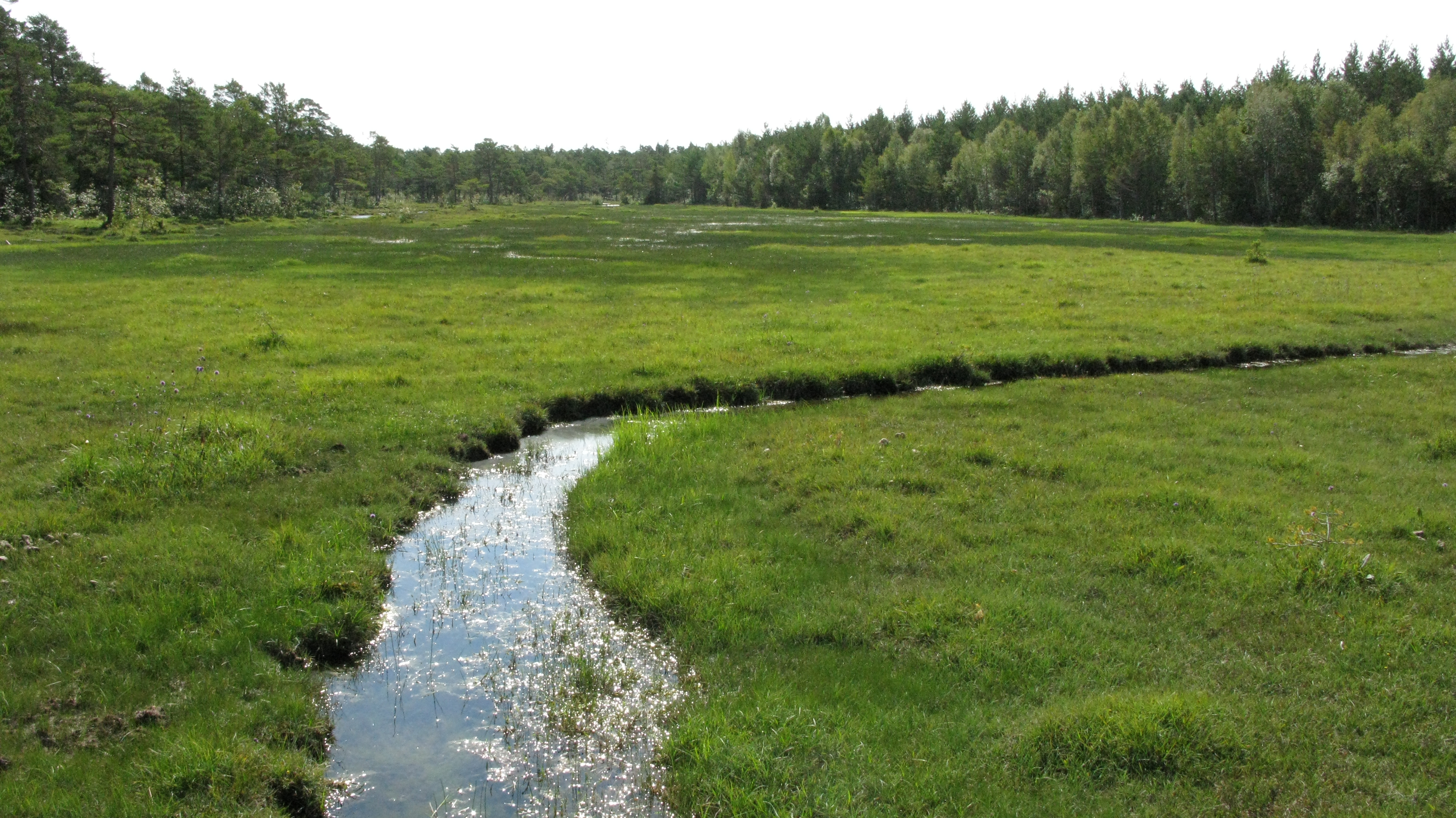
Accelerating Peatland Restoration through National Wetland Restoration Action Plan in Norway
Restoring carbon dense wetland such as peatland is an important contribution to safeguard existing carbon stocks,
Günther et al. 2020
Norwegian Environment Agency 2016, 2020
In 2016, Norway adopted the first generation of the national action plan on wetland restoration, covering a five-year period from 2016 – 2020. Currently, the second plan is in action, covering the period 2021–2025.
Norwegian Environment Agency 2020
The Wetland Restoration Action Plan (WRAP) is a follow up of the Norwegian National Biodiversity Strategy and Action Plan,
NBSAP; Norwegian Ministry of Climate and Environment 2015
Norwegian Environment Agency 2020
Restoring mires supports biodiversity and ensures carbon capture
The dominant wetland type in Norway is mires, covering 9% of the land area.
Bryn et al. 2018
Joosten et al. 2015
Joosten et al. 2015
Most of the degraded peatlands that have been restored under WRAP had one or several ditches draining the system. The drier conditions change the species composition and promote tree growth along the ditches. Measures used to restore the water table to ground level are removal of trees and blocking ditches. The ditches are filled with leftover wood, and plugs are made at a regular interval to stop the water flow. This hydrological restoration is called rewetting. The plugs are made of peat extracted on the site and placed at every 20 cm increase in elevation. When possible, the ditches are filled completely, and vegetation turfs placed back on top of the filled ditch. Excavators are used to perform the measures.
Restoring biodiversity and the ecological function of mire ecosystems is beneficial for carbon capture. Rewetting peatlands increases the water table level and stops the decomposition of organic matter in the peat layer. It does, however, also lead to anaerobic conditions, increasing the production of methane,
Günther et al. (2020)
IPCC AR5 (2014)
Günther et al. (2020)
Putkinen et al. (2018); Huth et al. (2021)
Monitoring is in place, but can be improved and must be continued
Long term monitoring is necessary to evaluate whether the three main goals of the Wetland Restoration Action Plan are met. Monitoring of the restoration outcome is established for two of the three restoration goals: i) Limit greenhouse gas emission and ii) improve ecological conditions. The effect for climate adaptation lacks monitoring. To evaluate if the goal to limit greenhouse is reached, fluxes of greenhouse gasses are monitored before and after restoration at one site in Trysil, Innlandet, using eddy covariance flux towers. In addition, the water table level is measured at the site. Vegetation is monitored at five sites to document the effect of restoration of vegetation
Hagen et al. (2015); Kyrkjeeide et al. (2018); Kyrkjeeide et al. (2021)
Lunde (2021)
Lunde (2021)
Peatmosses can provide further ecosystem services
The national action plans have accelerated peatland restoration in Norway, and peatland restoration has become one of the largest national restoration programs. Although the hydrological conditions seem to be restored at the sites, there is limited data on the success of the restoration on climate mitigation and ecological processes. Scaling up the monitoring of measures to evaluate the restoration success would aid in transferring the knowledge and competence, Norway has built up the last years, to neighbouring countries. The variation of mires found in Norway gives valuable experience in practical restoration work, as different mires may need individual approaches. The next step in Norwegian peatland restoration will be to include measures of ecological restoration, e.g., revegetation with peat mosses. This could further improve the ecosystems’ function, and when successful, eventually restore a wider range of ecosystem services. We see raising awareness of implementing such measures in mitigation of nature loss in development projects. As peat are still extracted in such projects, reuse of peat as a nature-based solution could limit the greenhouse gas emission and biodiversity loss.
Pointing out Eelgrass Meadows as Protected Areas in Sweden
The City of Gothenburg decided in 2021 to protect the remaining eelgrass meadows in the Gothenburg archipelago. The plan is to establish marine biotope conservation areas to protect the threatened ecosystem.
Drastic decline of eelgrass meadows in Bohuslän
Eelgrass (Zostera marina) is the most common seaweed along the Swedish west coast. It grows in shallow waters in muddy and sandy bays with low to moderate wave exposure, where it forms dense meadows.
Göteborgs Stad (2021)
Eelgrass has experienced a drastic decline in the northern hemisphere. In Bohuslän, about 60% of the eelgrass has disappeared since the 1980s, which is equivalent to a loss of 12,500 ha. The main reasons for the decline are associated with coastal eutrophication, overfishing and increased coastal exploitation.
Havs- och Vattenmyndigheten (2017); Göteborgs Stad (2021)
Havs- och vattenmyndigheten (2017)
Eelgrass meadows provide key habitats for marine species
Eelgrass meadows are critical to biodiversity. They provide an important habitat for species tied to shallow coastal areas and serve as nursery habitat for fish including commercially important fish such as Atlantic cod, whiting, and eel.
Havs- och vattenmyndigheten (2017)
Jahnke et al. (2020)
Due to the continued decline in population size associated with range reduction, deterioration in habitat quality, and decreasing numbers of reproductive individuals, eelgrass has been classified as vulnerable in the 2020 Swedish Red List.
SLU Artdatabanken (2020)
Eelgrass meadows act as carbon sink and help water regulation
Apart from providing habitats for marine species, eelgrass meadows provide a number of other ecosystem services. Not least, they are crucial for climate mitigation. Eelgrass meadows bind and store carbon in sediments,
Havs- och vattenmyndigheten,(2017)
Moksnes et al. (2021)
Duarte et al. (2013); Fourqurean et al. (2012); Prentice et al. (2020)
Eelgrass helps stabilize the bottom which reduces sediment resuspension. It also cycles nutrients such as nitrogen and phosphorus which reduces eutrophication. Both these effects have positive implications on water quality.
Havs- och vattenmyndigheten (2017)
Link to national and international policies
The decision by the city of Gothenburg to establish marine biotope areas contributes to the achievement of the national environmental objectives ‘A rich diversity of plant and animal life’ and ‘a balanced marine environment, flourishing coastal areas and archipelagos’.
Naturvårdsverket (2018)
Göteborgs Stad (2021); Göteborgs stad (2019)
Havs- och vattenmyndigheten (2017)
The effects are monitored
The suggestion to establish marine biotope areas in Bohuslän was accepted in 2021. The plan is to establish a marine biotope of an area of 20 ha. An evaluation of the distribution of eelgrass has been carried out by means of aerial photography, aerial photo interpretation by GIS and field verification. The evaluation showed a total area of 990 hectares of eelgrass meadows in the depth range of 0 to 6 meters within the sea area of the city of Gothenburg. The field verification pointed out that 35% of the number of eelgrass areas identified at the first aerial photo interpretation consisted of other vegetation or were vegetation-free at the time of verification.
Göteborgs stad (2021)
Preserving eelgrass meadows is more cost-effective than restoring or losing it
The costs of creating a marine biotope of 20 ha are estimated to be about 40, 000 SEK. Added to this are the working time amounting to 47,000 SEK (80 hours) and the costs for follow-up of 50,000 SEK every three years.
The costs of establishing the protected area were weighted against the costs if the area is not protected and the ecosystem is lost. The evaluation has shown that preserving eelgrass meadows is more cost-effective than restoring or losing it.
Göteborgs stad (2019)
Havs- och vattenmyndigheten (2017)
Göteborgs stad (2021)
Göteborgs Stad (2019)
Miljöpartiet (2021)
The costs for the assessment of the eelgrass meadows were partially funded with LONA grants provided by the Swedish Environmental Agency.
Göteborgs Stad (2019)
Stakeholder involvement
Within the city of Gothenburg Council, the main stakeholders involved are the building board and the Environment and Climate boards. Collaboration with neighbouring municipalities and the municipal network’s nature conservation group run by Energikontoret Väst is planned. The county administrative board cannot currently prioritize the creation of marine biotopes in the Gothenburg archipelago but offered support.
Afforestation done by Farmers - Payment for Ecosystem Services in Iceland
After settlement, woodlands in Iceland rapidly decreased from covering 25% of the terrestrial area to only covering 1% at the turn of the 20th century. Several afforestation projects have been initiated during the last century. Today, paying for ecosystem services (PES) schemes are the most used measure for afforestation projects. “Forestry on farms” is a popular afforestation scheme, where farmers are paid for afforesting their land. Afforestation is one of the measures in Iceland’s Climate Action Plan, and to execute this, the Government is going to increase funding to the scheme. There are numerous benefits to afforestation; besides carbon sequestration, afforestation can increase biodiversity, water quality, and provide better shelter for Icelandic farmland. However, the benefits depend on the choice of tree species, the type of land afforested, and the location of the land chosen for afforestation, not all land is appropriate for forestry. Namely biodiversity can suffer from land use change, land use change often leads to a change in species composition.
A century of afforestation in Iceland
The planting on the presidential estate Thingvellir in 1899 is the first afforestation project undertaken in Iceland. Iceland adopted their first Forestry Act in 1907, which already contained afforestation aspirations. A new forestry law was adopted in 1955, and since the 1950s, the forested area in Iceland has more than doubled.
Icelandic forestry service (2022a)
One of the first attempts to afforest private land with state funding took place in 1970. From 1950 to 1990, The Icelandic Forestry Service (IFS) was responsible for most of the afforestation, but since the 90’s, afforestation done by farmers has been the main source for new forests. In 1990, the Héraðsskógar Project was launched. This was the first regional afforestation project where farmers received government incentives for afforestation.
Brnkalakova et al. (2021)
The forested area in Iceland has increased annually with approx. 5% in the period 1990–2015. In 2016. the native birch forests covered 1,506 km and cultivated forests 400 km2. Carbon sequestration in forests planted after 1990 is equivalent to 210,000 tonnes of CO2.
Icelandic Forestry Service (2022b)
A new national law for the forests
The new Forestry Law was passed in 2019, replacing the old legislation from 1955 and the Act on Regional Afforestation Programmes from 2006.
Act on Regional Afforestation Programs on Icelandic farms no 95/2006 (2006)
Article 1 describes the aim of the new legislation:
a. To protect the country’s natural forest and support its natural expansion
b. To protect and restore biodiversity
c. To continue afforestation for increase the Icelandic timber stocks for sustainable use
d. To use the forests sustainably, in a way that give the users of the forest the biggest economic, social, and environmental benefits to society
The new legislation also prohibits clearcutting without permission.
Alþingi (2019)
Protecting and restoring biodiversity is one on the goals of the new Forestry Act. All planned forest plantations and afforestation efforts need to consider nature protection and landscape influence to prevent potential negative effects on biodiversity. Afforestation is considered one of the most effective measures to reclaim degraded land, re-establishing ecosystem processes, providing habitats, and preserve soil and water quality.
European Commisson (2021)
Reforestation and afforestation are often highlighted as nature-based solutions to mitigate climate change. Reforestation and afforestation are a key part of the Icelandic Climate Action Plan 2018–2030: “Reforestation and afforestation will be strengthened by a substantial increase in government funding to increase carbon uptake from the atmosphere, as well as for meeting other objectives. A special reforestation and afforestation plan will be made to allocate the increased resources”.
Ministry for the Environment and Natural Resources (2020)
The Environment Agency of Iceland (2022)
In collaboration with the EU: Forest reference levels & the regulation on land use, land-use change and forestry
Iceland is part of EFTA. In 2020, Forest Reference Levels (FRLs) for Iceland was adopted. FRLs are used across the EU to account for greenhouse gas emissions and removals. They are a useful tool to track how managed forests contribute to the climate efforts of a country. Adoption of FRLs in Iceland is a result of a decision for the EFTA countries to extend the EU collaboration on climate actions, aligned under the regulation on land use, land-use change and forestry (LULUCF Regulation).
ESA (2020)
The Icelandic Ministry of the Environment and Natural Resources have published their planned LULUCF activities for the period of 2019–2022, where one of the activities is an increase in annual afforestation from 1,100 ha (2018) to 2,300 ha in 2022. The main measure to achieve this is by increasing grants for the farm afforestation scheme.
Icelandic Forestry Service (2019)
EU policies promote similar measures
The EU recognizes a need to reward farmers and landholders for the provision of forest ecosystem services, such as carbon sequestration. In 2021, the European Commission approved The New Forest Strategy for 2030. In the new strategy, Payment for Ecosystem Services (PES) schemes, such as the Icelandic afforestation scheme, is listed as a successful measure for rewarding farmers for their provisioning services.
European Commisson (2021)
Payment for Ecosystem Services (PES)
are defined as a transfer of resources between social actors, which aim to create incentives to align individual and (or) collective land use decisions with the social interest in the management of natural resources to enhance or safeguard the provision of specific or bundled ES.
Other EU action plans also promote the use of PES schemes as an important policy tool for implementing European Green Deal
European Commisson (2019)
European Commission (2020)
The farm afforestation scheme Forestry on Farms since 2016
Researchers interviewed several farmers who have done afforestation projects on their lands with funding from the farm afforestation scheme. The study found that: “Overall, farmers have recognized the positive impact of afforestation on various regulating, cultural, and provisioning ES.”
Brnkalakova et al. (2021)
Observed benefits from Participation | Obstacles – room for improvement |
|
|
Successful afforestation
Brnkalakova et al. (2021)
Afforestation on Iceland: Choosing the right kind of tree
Large scale afforestation began by end 20th century with the regional afforestation programmes. One of the primary goals were initially to support rural development,
Brnkalakova et al. (2021)
Government of Iceland (2020).
Nordic Council of Ministers (1996)
Breeding and test programmes are on-going for several tree species. These include efforts to better adapt the trees to the current Icelandic climate and a future warmer climate with what it entails of pests and pathogens. Climate change is likely to impact what tree species that thrive in Iceland. There are for example indications that the native birch will suffer in a warming climate.
Icelandic Forest Service (2022a)
When a forest is established on previously unforested land or land deforested centuries ago, it affects ecosystems, landscapes, and rural development all together; especially when new tree species are introduced, which is sometimes the case in Iceland. It is not a foregone conclusion that an afforestation project will benefit biodiversity.
Nordic Council of Ministers (2008)
Conflict of interests on limited land
There are continuing discussions in Iceland on how increasing afforestation schemes impact biodiversity, namely how it impacts migratory birds by altering their breeding grounds.
Nordic Council of Ministers (2008); Pálsdóttir et al. (2022)
Nordic Council of Ministers (2008); Pálsdóttir et al. (2022)
Icelandic Institute of Natural History (2022)
rsson et al. (2005)
A recent study shows that size and shape of the forest patches impact wildlife differently, and the pressures on migratory birds tend to be higher when afforestation occurs in small, dispersed blocks across the land, compared to when it is concentrated in on large block instead. It is therefore important to have an overall cohesive strategy for the afforestation schemes in Iceland that account for biodiversity conservation.
Pálsdóttir et al. (2022)
A government Resolution to Change the Path of Peatlands in Finland
Efforts by the Finnish Government to protect and restore peatlands were accelerated in 2011 with a Peatland Strategy issued by the Ministry of the Agriculture and Forestry. The strategy was followed by a Government Resolution on the Sustainable Use and Protection of Peatland in 2012, and a proposal for a Conservation Programme in 2015.
The Finnish Government (2012)
The Finnish Government (2013)
Wetlands make up approximately a third of Finland's land area. Drainage of peatlands for forest production has been a large-scale land use change since the 1950s. Additionally, peatlands have been used for agriculture and peat extraction, providing resources for fuel and growth medium for plants. The drainage and extraction of peat has been most prevalent in the southern part of the country, while peatlands in the northern part of the country to a larger extent have been left untouched. The history of peatland exploitation is reflected in the current protection state of peatlands, as 66% of protected peatlands are located in northern Finland.
GTK (2020)
Drainage and peat extraction lead to wide-scale greenhouse gas emission and ecological degradation
Peatland drainage has significant effects on greenhouse gas emissions, as it oxygenates organic material and allows for decomposition, which releases CO2 and other greenhouse gases to the atmosphere. The greatest carbon losses in Finland are a result of peatlands drained for forestry, but drainage for agricultural land, peat extraction and other exploitation forms have also contributed to decreases in the peatland carbon pools. Moreover, drainage disturbs the nutrient cycle, contributing to nutrient leaching through runoff water as well as leaching of metals, dissolved organic carbon and particles.
Menberu et al. (2017)
Finnish peatlands host unique ecosystems with species that commonly are poorly adapted to other habitats. Degradation of peatland habitat has as such led to decline in biodiversity in these areas. As an example, population sizes of peatland birds in Finland declined by 50% in 1981–2014.
Fraixedas, S. et al. (2017)
The National Peatland Strategy in line with EU regulation
The Finnish Peatland Strategy was decided in 2011 and followed by a Government Resolution on the Sustainable Use and Protection of Peatland in 2012, which implemented the ecosystem approach of the 2011 strategy and environmental, social and economic objectives. Together with the Conservation Programme of 2015,
The Finnish Government (2012)
The Finnish Government (2013)
At EU level, the Habitats directive and the Natura 2000 network of protected areas draw up the legal framework for peatland protection. Peatlands are also a part of the EU Biodiversity Strategy, where peatlands are one of the target nature types for strict protection. In June 2022, the Commission of the European Union adopted a proposal on an EU Restoration Law which will include binding targets for peatland restoration.
European Commission (2022)
Synergies between biodiversity decline and climate effects are clear and can be addressed as such
Plant communities have been found to guide the rate of CO2 assimilation in mires, and loss of native communities lowers the rate, providing an example of the interlinkage between biodiversity decline and negative climate effects.
Leppälä et al. (2011); Riutta et al. (2006)
Meanwhile, there are synergistic measures which provide benefits for the climate and biodiversity. Several complementary political measures have followed the Government Resolution. Legal instruments were implemented through amendments in the Forest Act and the Environment Protection Act in 2014.
Salomaa et al. (2018)
METSO (2022); Finland’s Ministry of the Environment (2022)
Protection and restoration as on the ground measures
Around 14% of peatlands currently lie in protected areas. Peatland restoration has been done at a large scale in Finland, resulting in 25,000 ha of mires in protected areas restored between 1989 and 2018. The mainstream method for restoration projects has been according to a best practice handbook by Metsähallitus Natural Heritage Services and The Finnish Environmental Institute.
Similä et al. (2014)
Biodiversity wins – but an array of measures is needed for cost-effective implementation
The Finnish Nature Panel is an independent board of scientists that are appointed to collect scientific evidence for the decision making in Finland. They have concluded that peatland restoration is an important tool for safeguarding biodiversity in Finland.
Finnish Nature Panel (2021)
A study on data from almost 800 state-owned forestry-drained peatland stands in Northern Finland examined the effects of seven different land use and land management options for peatlands on biodiversity, climate impact and water emissions. The study aimed to find which combinations that could contribute jointly to biodiversity and ecosystem services such as climate mitigation and water protection in a cost-effective manner. It was concluded that trade-offs between biodiversity and previously mentioned ecosystem services, indicating that compromises in land use and land management were necessary in order to cost-effectively provide biodiversity, climate change mitigation and water protection, since no management option alone can fulfil all objectives. In order to manage cost-effectively, a combination of management options is therefore needed.
Juutinen et al. (2020)
Local people in favour of protection and restoration
When people in the northern Ostrobothnia region were surveyed on their opinions about peatland use, all respondent categories preferred increase of nature protection and continued restoration of peatlands. This indicated a wide consensus among the local population with the institutional goals of peatland restoration and protection. People whose livelihood depends on productive use of peatlands were more likely to also value continued or increased industrial activities in peatlands, highlighting that despite general agreement on protecting natural values, there are differing preferences on the use of peatlands. When planning local management, it is essential to assimilate these varying preferences while also using the opinions of the local population as an enabler of sustainable transition.
Tolvanen et al. (2013)
Promoting Green Roofs in Local Plans in Denmark
The City of Copenhagen promotes green roofs when new construction in the city is planned. It is a voluntary measure that has resulted in an increase in green roofs in the city. There are multiple benefits that can be gained from green roofs when it comes to climate adaptation, biodiversity and pollution. However, these vary greatly between different types of green roofs.
Cities are very vulnerable to climate change. Cities are characterized by large impermeable surfaces, increasing the risk of flooding and damage during heavy rain falls. Temperature dynamics are also different in cities; the grey infrastructure of buildings and roads store heat, and only release it very slowly, allowing the temperature in the city to increase. The dynamics of city heating are called the urban heat-island effect, and the phenomenon is expected to increase in the future due to climate-change, especially in the Nordics.
Zandersen et al. (2014)
The expansion of cities and infrastructure disrupts the surrounding landscape and acts as barriers for species. In the last couple of decades, nature-based solutions in an urban setting have received a lot of attention for the ability to target multiple crises at once. One measure for nature-based solutions in the city is green roofs. Green roofs as green architecture can contribute to mitigating several threats posed by climate change. Green roofs have the potential to provide several ecosystem services such as habitats services, regulating services, provisioning services and cultural services. Plants have a cooling effect due to increased evaporation.
Zandersen et al. (2014)
Jensen & Møller (2013)
The thicker the better
Green roof is an urban nature-based adaptation measure. It is estimated that green roofs can take 50–80% of the yearly precipitation
Københavns Kommune (2012)
Zandersen et al. (2014)
Irga et al. (2021)
There are different types of green roofs, the type of greenery suitable for a given roof depends on the thickness of the substrate which again depends on the roof’s carrying capacity.
Frederiksberg Kommune (2013)
Københavns Kommune (2012)
Table 2. Presentation of three different types of green roofs and their respective qualities, Adapted from: Frederiksberg Kommune (2013). Grønne tage og taghaver – kombineret med klimatilpasning i form af LAR og energibesparende tiltag & Københavns Kommune (2012). Grønne tage Det livgivende, klimatilpassede alternativ.
TYPES OF GREEN ROOFS | Extensive | Semi-intensive | Intensive |
Short description | Environmental landscape | Environmental landscape & Gardens | Gardens & Parks |
Access/stay | Very limited access | Access possible | Full accessibility |
Type of vegetation | Mosses, sedum, herbs, & grasses | Grasses, herbs, & shrubs | Lawn, perennial plants, shrubs, & trees |
Watering | None | Periodical | Regularly |
Thickness of substrate | 60–200 | 120–250 mm | 150–400 mm |
Weight | 60–150 kg/m | 120–200 kg/m | 180–500 kg/m |
Costs | Low | Medium | High |
Green roofs have the potential to support biodiversity in the city. Urban green spaces can provide habitats for flora and fauna in the city, and studies show increased fauna species diversity on green roofs compared to conventional roofs.
Wooster et al. (2022); Filazzola (2019)
Zandersen et al. (2014)
Hudekova (2020)
The main air pollutants in Copenhagen that exceed threshold values are Nitrogen dioxide and air borne particulate matter (PM10 and PM2.5).
Jensen & Møller (2013)
Zakrisson (2019)
Jensen & Møller (2013)
A successful voluntary measure
In 2009, the Municipality of Copenhagen published the draft for a climate plan for Copenhagen,
Københavns Kommune (2009)
Teknik- og Miljøforvaltningen (2010)
COWI (2009)
Københavns kommune (2009)
In 2019 it was estimated that approximately 17% of new buildings are constructed with green roofs, which can be considered a successful outcome of a voluntary scheme. According to the Department for Engineering and Environmental Management, green roofs in Copenhagen amounted to 320 000 m2 in 2019, almost reaching the 2015 goal. The majority of Copenhagen’s green roofs are the extensive roof type with sedum shrubs. In local development plans, green roofs are mentioned as a suggestive measure, to be implemented when assessed to be suitable.
Nielsen (2019A)
In the guidelines for environment in construction and facilities from 2016, green roofs are mentioned second in the hierarchy for local handling of rainwater.
Nielsen (2019B)
Københavns Kommune (2015)
Today, there is a need for an actual strategy for green roofs in Copenhagen, to set the trajectory moving onwards. However, the example of Copenhagen illustrates that there can be a way forward when stricter regulation is not an option.
Expertise in our own Region
Even though green roofs are a relatively new measure as green infrastructure in city planning and urban construction, there is a long tradition across the Nordics to construct green roofs on traditional huts and houses. Norway, The Faroe Islands, and Iceland especially have a strong tradition of constructing turf roofs on their buildings.
Jim (2017)
Jim (2017)
Jensen & Møller (2013)
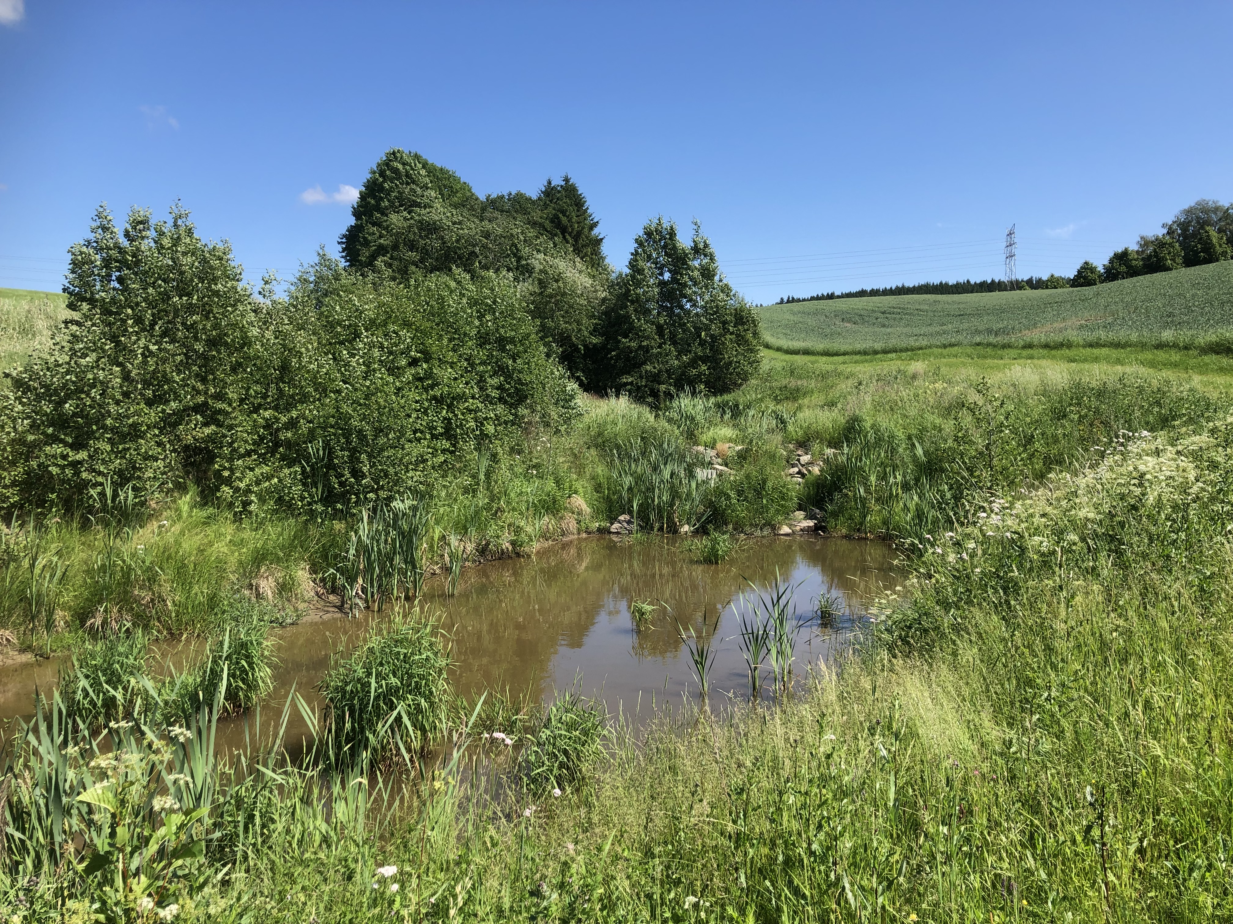
Riparian Vegetation Protection Acts Safeguards Nature-based Solutions in Norway
Protecting or restoring riparian vegetation can be a relatively easy implemented and affordable measure for ensuring nature-based solutions
Pulg et al. (2018); Skarbøvik et al. (2018)
Magnusen et al. (2019)
Staubo et al. (2019); Mürer (2019)
Riparian vegetation can be defined as the natural vegetation such as trees and bushes, growing along waterways from the water’s edge to land areas that are not flooded.
Pulg et al. (2018)
Riparian vegetation provides numerous eco-system services
Precipitation has increased in Norway and is expected to increase further in both frequency and intensity in the period towards 2100 as a result of climate-change.
Norw. Environmental Agency (2021)
Magnussen et al. (2019)
Pulg et al. (2018); Vannportalen.no
Magnussen et al. (2019)
Jonassen (2009)
Climate-change will also increase the frequency and severity of flooding in Norway, especially as a result of heavy rain.
Norwegian Environmental Agency (2021)
NIBIO (2020)
Norw. Environmental Agency (2022)
Riparian vegetation is important for biodiversity in and around waterways. It provides food and habitat for terrestrial and aquatic biodiversity such as fish, birds, and pollinating insects, as well as connectivity between habitat patches.
Staubo et al. (2019)
The effectiveness of regulations – some success stories and a way forward
Research on riparian vegetation in Norway seems to be relatively sector-based (e.g., related to farming, forestry). Below are some encouraging results from selected research projects carried out by the Norwegian Institute of Bioeconomy Research (NIBIO):
- Krzeminska et al., (2022) found a considerable effect of the existing riparian vegetation on soil and phosphorus retention in Vestfold, a region in southern Norway.
- Stokland (2021) found that forestry in riparian zones has been reduced in Norway the last 15 years. The study found that in 71–80 % of cases with logging in areas close to wetlands, rivers or lakes, a belt of riparian vegetation that was 5 meters or wider was left in 2017. For streams this percentage dropped to 29 % of streams.
- In 2001–2006, approximately 10 000 trees were planted along waterways in Våler municipality and approximately 34 % had survived in 2017 (Skarbøvik et al., 2018). Property owners were largely positive to these re-vegetation efforts (Ibid). A new effort to plant trees along streams has been initiated in four river basin sub-districts I South-Eastern Norway.
On a less positive note, there are also reports of riparian vegetation being exposed to illegal clearcutting and cultivation in Norway (Bjørkli and Wiseth 2018) and in some cases decision-making that allows human activity in these areas are made without enough knowledge about the consequences Aanderaa et al. 2020.
Maintaining riparian vegetation – an extensive set of regulations
Protection and revegetation of natural vegetation growing along waterways are considered relatively affordable measures.
Pulg et al. (2018)
Staubo et al. (2019)
Mürer (2019)
A central act is the Norwegian Water Resources Act (WRA). It states that along the banks of waterways with year-round waterflow, a natural belt of vegetation should be maintained to reduce runoff and provide habitat for plants and wildlife (WRA § 11). However, there are some challenges. For instance, no law governs revegetation of riparian zones that are presently without vegetation, and the Norwegian Soil Act states that areas of food production should be maintained and kept for food production.
Blankenberg et al. (2017)
Exemptions (permits) from the WRA can be made in certain cases and it is the ecological function of riparian vegetation that should be protected and not the vegetation as such.
WRA § 11; Staubo et al. (2019)
Larsen (2022); NIBIO (2020)
Staubo et al. (2019)
Property owners and the municipality should maintain riparian vegetation through their land management and land use planning, respectively. The municipality should also determine the width of the area that should be maintained when needed.
Staubo et al. (2019)
Pulg et al. (2018)
Pulg et al. (2018)
No studies have assessed the state of riparian vegetation nationwide and its implication for outcomes such as climate adaptation, climate mitigation and biodiversity. Research has also yet to be synthesized across sectors. As a potential way forward, indicators of riparian vegetation state could be included (more comprehensively, in some cases) in environmental state assessments under the Water Framework Directive (2000) of waters in the EU and Norway.
González del Tánago et al. (2021)
Action plans for Threatened Species and Habitats in Sweden
Existing measures, such as protected areas, and measures for sustainable land and water use are not sufficient for the conservation of several endangered species.
SLU (2022)
Naturvårdsverket, no date
SLU (2022)
Most action plans for threatened species and habitats in Sweden focus on the conservation of individual species, but some also focus on specific habitats associated with multiple endangered species. Several factors are considered when selecting species to be covered by the plans, including the species' threat status, international obligations, state of knowledge, and the possibility of improving population size through management or conservation measures.
SLU (2022)
Naturvårdsverket, no date
The Action Plans for Threatened Species and Habitats are linked to the Swedish environmental objective “A Rich Diversity of Plant and Animal Life”
SLU (2022)
Naturvårdsverket (2022)
One of the major obstacles identified in a recent evaluation was the lack of financial resources. Available financial resources were considered insufficient to meet identified needs and ensure long-term strategic planning.
Naturvårdsverket (2022)
Collaboration at landscape level
One of the biggest successes of these programmes is the collaboration at landscape level. Stakeholders involved are the Swedish Environmental Protection Agency, the Swedish Agency for Marine and Water Management, the county administrative boards, and other relevant actors such as landowners, municipalities and NGO’s. The Swedish Environmental Protection Agency and the Swedish Agency for Marine and Water Management have the overall responsibility for the work and determine the action plans with help of SLU ArtDataBanken. Currently, SEPA is responsible for 132
Naturvårdsverket, no date
SLU (2022)
The county administrative boards receive annual grants to undertake operations, either internally or by hiring contractors or landowners. Landowners can receive funding for carrying out conservation measures on their land. In addition, there is a collaboration between SLU Artdatabanken, the county administrative boards, the Center for Biological Diversity (CBM), and infrastructure agencies on a variety of management issues, including roadsides, embankments, and power lines.
SLU (2022)
Naturvårdsverket (2022)
Synergy biodiversity and climate
While the climate benefits of the action plans have not been evaluated, it is likely that some of the action plans have positive unintended climate effects. One example is the action plan on the conservation of rich fens (Åtgärdsprogram för bevarande av rikkärr). Rich fens have been negatively affected by drainage for agricultural and forestry purposes in Sweden. The action plans on rich fens focused, inter alia, on conducting inventories on rich fens and the restoration of this type of habitat by closing ditches, increasing mowing and site-specific management. The reason for this effort was biodiversity conservation as this habitat type is home to 160 red-listed species, of which 74 species are considered threatened.
Sundberg (2006)
SLU (2017)
Laine et al. (2019)
Another impact of peatland restoration is water regulation. Mires accumulate carbon organic matter and retain nutrients and other elements. This has positive effects on water quality and decreases freshwater eutrophication and acidification.
Bonn & Stoneman (2016)
Examples of successful outcomes
Many action plans have been running for several years. One example where the action plan has proven successful was the action plan for the Swedish tree frog (Hyla arborea). It succeeded in building a viable population of a species that was previously threatened with extinction (NT).
Naturvårdsverket, no date
Reclaiming Degraded Land to Mitigate Climate Change in Iceland
One of the key mitigating measures in Iceland’s Climate Action Plan is carbon sequestration by revegetation of degraded land. Due to centuries of land degradation caused both by anthropogenic and natural events, 40% of Iceland’s terrestrial area is degraded today. Numerous land reclamation projects have been done over the years. The aims have evolved from focusing on halting sand drifting and ensuring land for agricultural purposes, to having more of an ecosystem-based approach, aiming to restore ecosystem services, biodiversity, carbon sequestration and disaster risk reduction.
Iceland launched their new climate strategy for being carbon neutral by 2040. 7 bn Icelandic kronor was allocated to climate mitigation measures in the LULUCF sector.
Government of Iceland (2018)
Land degradation and soil erosion are of serious concern in Iceland. Iceland was settled in the late 9th century, and in the following centuries, large parts of Iceland was deforested. Other vegetation disappeared from large parts of the country, as extensive grazing hampered natural revegetation, leaving the soil degraded, prone to erosion, and increasingly desertified. The trajectory of soil erosion and desertification escalated further due to the Icelandic weather and ash depositions from volcanic eruptions.
Arnalds (1987)
Up through the 19th century there were several efforts with re-vegetation using non-native plants to hinder drifting sand. In 1907, The Soil Conservation Service of Iceland (SCSI) was founded, and there were several reclamation efforts undertaken up through the 1900s.
In the beginning of the century, efforts were concentrated in the eastern parts of Iceland, focusing on combating drifting sands. From 1947 and onwards, more resources and labour forces were allocated to the field and the reclamation efforts expanded, gradually increasing towards the end of the 20th century. Sand drifting has posed major problems especially for Icelandic farmers by affecting the quality of grazing areas. Many of the reclamation efforts addressed this specifically. In recent decades, the focus has changed, and the objectives for land reclamation and restoration have become more diverse. Particularly climate change mitigation and biodiversity are of more concern
Arnalds et al (2001)
Article 1: The purpose of the law is to protect, restore and improve the nation’s resources of soil and vegetation, and to ensure sustainable land use.
Althingi (2018)
Climate Action Plan for Iceland
Iceland published their latest climate action plan in 2018, with an updated version published in 2020. Actions to reduce emissions and increase carbon sequestration through improved land use, land use change and forestry (LULUCF), are a significant part of the Icelandic Climate Action Plan.
When the 2018 Climate Action Plan was published, emphasis was put on the possibility to tackle multiple environmental crises, Iceland is facing: Improving biodiversity, increasing ecosystem resilience against extreme weather events, and combatting desertification when applying mitigation measures. The updated Climate Action Plan from 2020 continued to focus on carbon sequestration as a key mitigation measure. The 2021 progress report reported the measure I.2 Expanding revegetation (also called Enhanced action in land reclamation) to be implemented.
The environment Agency of Iceland (2022)
The environment Agency of Iceland (2022)
The Icelandic Government has also published a Climate Change Mitigation Plan, specifically for the Land use, land-use change and forestry sector in 2019. The plan elaborates further on land restoration; especially in collaboration with farmers
The environment Agency of Iceland (2022)
Government of Iceland (2020)
In 2022, the Ministry of the Environment, Energy and Climate published: “Report on Policies, Measures, and Projections: Projections of Greenhouse Gas Emissions in Iceland until 2040”, the report is based on the Climate Action plan from 2020. The report projects different trajectories depending on what measures are implemented. Figure 5 below shows two scenarios for carbon sequestration from soil reclamation. The orange trajectory is soil reclamation Business as Usual (BAU), based on historical trends; the blue is soil reclamation With Existing Measures (WEM), existing measures assume implementation of the 2020 Climate Action Plan measure for expanding revegetation. The projections show increased emission impact for soil reclamation WEM compared to BAU.
Figure 6. Projection showing net CO2 emissions will change under two different scenarios for soil reclamation Business as usual (BAU) and with existing measures (WEM). The two scenarios are projected up until 2040. The figure shows how the biggest reduction in emissions occur under the WEM scenario. Figure from: Environment Agency of Iceland, Icelandic Forest Service & Soil Conservation Service of Iceland (2022): Report on Policies, Measures, and Projections.
Biodiversity
The latest Biodiversity action plan for Iceland is from 2013. A big part of the efforts during the last decades have been in research, documentation and monitoring Icelandic biodiversity, to increase data on the current state of biodiversity, and to ensure the right measures are implemented moving forward. 11 of the 48 actions concern restoration of degraded habitats, especially focusing on revegetation by afforestation and natural succession enabled by a reduced grazing pressure.
Ministry for the environment and natural resources (2004)
Government of Iceland (2019)
Pollution
Iceland is located on the Mid-Atlantic Ridge, and many of its volcanoes are still active. When volcanoes erupt, they can eject tephra. Tephra is air borne volcanic materiel.
Tephra is air borne Vulcanus materiel
Ágústsdóttir (2015)
Aradóttir et al. (2000)
The Hekluskógar Project: Soil reclamation at the foot of an active volcano
The project was initiated in 2007 and covers 90,000 ha of degraded land (approximately 1% of Iceland).
Òskarsson (2009)
Òskarsson (2009)
- Eliminate drifting sand, revegetate eroded land to improve reforestation
- Establishing seed sources of native birch and willow shrubs
- To facilitate natural distribution and expansion from established woodlands
A lot of the land in the area is privately owned, and farmers have been encouraged to join the project. By 2014 a total of 210 landowners have joined the project and are promoting reforestation measures on their own and public land.
Òskarsson (2009)
Iceland’s Forest Service (2022)
Òskarsson (2009)
Thorsson & Petursdottir (2015)
Promoting Synergy Projects – National Subsidy Program in Denmark
The majority of the area of Denmark is used for agriculture, and only ten percent of the land is protected nature. Furthermore, nature is under pressure in many places, especially from agriculture, which is a source of nitrogen pollution that threatens both terrestrial biotopes and waterbodies. In 2016, money was set aside for a subsidy program for synergy projects as part of a governmental adopted nature package. Danish municipalities could apply for funding to climate adaptation projects that also co-benefit nature, decrease nitrogen pollution and create local recreational value. The subsidy fund proved to be very popular and a total of 12 projects received funding and were carried through.
In 2016, the Danish Government passed a nature package, constituting an Action Plan for Nature Management Policies in Denmark (“Naturpakken” in Danish). The key targets in the plan were to ensure climate change adaptation, increase nature areas, decrease nitrogen releases to the environment, and improve outdoor recreation facilities.
Miljø- og Fødevareministeriet (2016)
Ministeriet for Fødevarer, Landbrug og Fiskeri (2016A)
The projects were described as “lighthouse projects”, meant to inspire other municipalities or state entities with the possibilities to create synergistic effects across different policy areas in collaboration with multiple stakeholders.
Ministeriet for Fødevarer, Landbrug og Fiskeri (2016B)
Ministeriet for Fødevarer, Landbrug og Fiskeri (2016C)
The projects should focus on flood-prone areas, mapped in the municipal climate adaptation plans and must include climate adaptive measures able to withhold or delay water from heavy rainfalls or other upland waterbodies. It was not required that projects included synergies with all the other goals being nature, recreation and nitrogen pollution. However, the chances of getting funding increased when all were incorporated. The projects were ranked after score, and the different criteria scored differently based on what was considered most important.
Miljøstyrelsen (2016)
Different types of synergies and levels of stakeholder involvement
The project grants were given to very different projects, combining different types of synergies. Re-meandering of streams, establishing dykes, and restoring biodiversity and habitats were among the most frequent actions, whereas afforestation was one of the least implemented activities.
In order to carry through the projects, different stakeholders were involved in the project planning and implementation, with the municipalities as common denominator.
The table below provides an overview of all the selected projects that were implemented, the focus areas, the measures applied, and stakeholders that were part of the process.
Project | Restoration | Stakeholders | Focus | ||||||||||||
|---|---|---|---|---|---|---|---|---|---|---|---|---|---|---|---|
A | B | C | D | E | F | G | H | I | J | K | L | M | N | O | |
Odsherred Municipality – the brook “Grønnehave bæk” | X | X | X | X | X | X | X | X | X | X | X | X | |||
Randers Municipality – The meadow “Storkeengen” | X | X | X | X | X | X | |||||||||
Vejle Municipality – Grejs river valley | X | X | X | X | X | X | X | X | |||||||
Kolding Municipality – the stream “Seest Mølleå” | X | X | X | X | X | X | X | X | X | X | |||||
Odense Municipality – Seden beachtown | X | X | X | X | X | X | X | X | X | X | |||||
Allerød Municipality – Kedelsø-Langesø stream – The living river valley | X | X | X | X | X | X | X | X | X | X | X | ||||
Næstved Municipality – the stream “Ellebækken” | X | X | X | X | X | X | X | X | |||||||
Aarhus municipality – The water in Malling | X | X | X | X | X | X | X | X | X | X | X | ||||
Thisted Kommune – Tingstrup lake | X | X | X | X | X | X | X | X | |||||||
Assens Municipality – Tommerup | X | X | X | X | X | X | X | X | X | X | X | X | X | ||
Favrskov Municipality – Kollerup meadows | X | X | X | X | X | X | X | ||||||||
Næstved Municipality – the brook” Rønnebækken” | X | X | X | X | X | X | X | X | X | X | |||||
A = Re-meander streams
B = Reopen piped water ways
C = Creation of rainwater basin
D = Afforestation
E = Dyke Construction
F = Lake or wetland establishment
G = Habitat restoration/ creation
H = Nitrogen removal
I = Municipality
J = Civil Society Organization
K = Utility company
L = Climate adaptation
M = Nature and Biodiversity
N = Pollution prevention
O = Recreational value
The synergy project in Odsherred Municipality
The Municipality of Odsherred received funding to establish a wetland area and re-meander the stream Grønnehave Bæk to protect parts of the city Nykøbing Sjælland against flooding. Rainwater from the local residence area is now led through the newly created wetlands together with water from the surrounding agricultural upland. Nitrogen and other nutrients are filtered out of the water, while passing through the wetland area, before it reaches the Bay, minimizing eutrophication and improving the coastal water and habitat quality. The municipality expects that re-meandering and restoring the stream will bring back sea trout and eel. It is also expected that the wetland will increase carbon storage, thus contributing to climate mitigation.
Odsherred Kommune (2022)
The actual effects have not been evaluated
The synergy subsidy pool had synergies at its core, but the high interest shows that there is willingness and an interest from the Danish municipalities to target multiple agendas simultaneously and in the same project, when funding is provided. However, it is important to acknowledge that the projects have not been evaluated. Some of the climate adaptive measures have been successfully tested by heavy rainfalls, but the projects have not been evaluated in relation to nature and biodiversity, so the success of the subsidy pool to achieve multiple goals across several agendas have not been assessed.
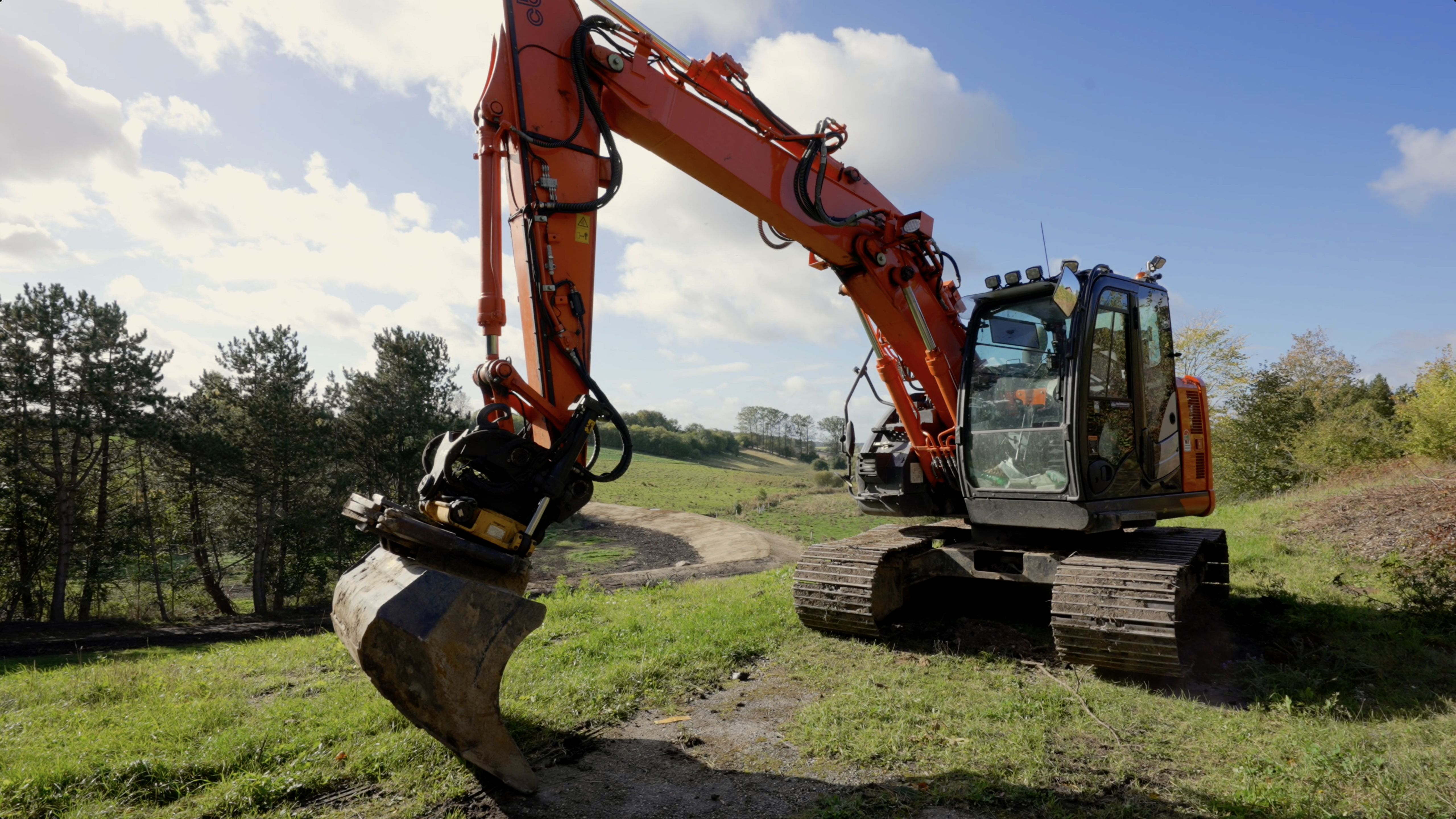
Photo: David Buchmann
Preserving Biodiversity through Payment for Ecosystem Services: The Forest Biodiversity Programme METSO in Finland
Based on a long tradition, forest land in Finland is primarily privately owned. In 2016, state owned forest covered 26%, while private forests covered about 60% of all forested land.
Privately owned forests are located predominantly in southern Finland, where the relatively warm climate sustains the richest biodiversity. Until the turn of the Millennium, there were a shortage of policies and practices for actively protecting and enhancing biodiversity in privately owned forests. The METSO Programme, a Payment for Ecosystem-services Programme, offering compensation to landowners for conserving forest areas for biodiversity, was initiated in 2008. It draws on multidisciplinary scientific research and runs in Southern Finland. Currently (2022), it is set to continue until 2030.
LUKE (2022A); Tikka & Kauppi (2003); Mayer & Tikka (2006)
Privately owned forests are located predominantly in southern Finland, where the relatively warm climate sustains the richest biodiversity. Until the turn of the Millennium, there were a shortage of policies and practices for actively protecting and enhancing biodiversity in privately owned forests. The METSO Programme, a Payment for Ecosystem-services Programme, offering compensation to landowners for conserving forest areas for biodiversity, was initiated in 2008. It draws on multidisciplinary scientific research and runs in Southern Finland. Currently (2022), it is set to continue until 2030.
Tikka & Kauppi (2003)
The population of Finland is 5.5. million, the number of forest owners is 620,000, and an average forest holding covers 30.5 ha. In Southern Finland, 72% of the forests are privately owned.
Ministry of the Environment & Statistics Finland (2017)
Different options for different needs
METSO is based on three pillars: permanent protection as private nature reserves, fixed-term conservation, and nature management and restoration projects (see Box X). The potential sites to be included into the METSO Programme are ranked according to their ecological structure and their value for biodiversity. Regional environmental and forest authorities determine whether a site is accepted into the programme.
Administrative options within METSO | |
|---|---|
Permanent protection as private nature reserves | |
Land ownership remains unchanged, but the forest is permanently protected. Re-gional authorities cover a fee, which is ex-empt from taxation. | Selling the land to the State for conservation pur-poses, thus building up the network of protection areas on public land. |
In both cases the regional authorities assess the environmental values of the property and may accept or reject the landowner’s METSO application. | |
Fixed-term conservation | |
Environmental forestry subsidy agreement (10 years) Land ownership remains unchanged, but forest management operations are paused for 10 years. The subsidy is proportional to the economic value of the standing trees. | Temporary nature reserve (20 years) Land ownership is unchanged, but the forest is protected from logging for 20 years. Regional authorities offer a monetary compensation. |
Nature management and restoration projects | |
The Finnish Forest Centre (FFC) prepares several restoration plans which extend geographically over forests of several landowners. FFC declares that these plans are potentially available for restoration subsidy. Entrepreneurs or active citizens apply for project leadership, accepting the responsibility to carry out the restoration project. Finally, FCC decides which plans will be activated, and reserves the necessary funds. | |
The goal for METSO is to protect 96,000 ha of forest through the program before the end of 2025.
METSO (2022)
Public perception and funding as enablers
Finnish NGOs and the civil society initially criticised METSO for the low level of ambition. More recently, as the program has evolved, this criticism has weakened, and critical voices have demanded more METSO funding into the government budget.
During 2008–2021, METSO projects covered a total of 71,147 ha on private lands ha.
Koskela et al. (2022)
LUKE (2022B)
Climate change and the METSO Programme
METSO was designed during 1997–2008, when climate change mitigation and adaptation were discussed, but not yet prioritized in environmental policy. Co-benefits between policies addressing biodiversity and climate change are likely to exist, especially for adaptation and the implementation methods. When productive forestry use is restricted due to permanent protection or fixed term conservation or restoration efforts, it provides an opportunity for increased carbon storage. With less carbon removed from the forest as harvest, there is build-up of carbon stock both in standing wood as well as on the forest floor. This is part of a process where the forest transitions towards more natural carbon cycling. The potential for carbon sequestration and storage is regulated by several factors, including soil type, climatic conditions, age of forest, and tree species mix. The rate of carbon uptake decreases over time in forest ecosystems, moving on a gradient from carbon sink to carbon stock. Protecting young forest can therefore have relatively higher climate benefit. Meanwhile, preserving old-growth forest has higher biodiversity benefit, while it also stores larger amounts of carbon. There are as such several criteria to consider maximising the synergies between climate change mitigation and adaptation, and biodiversity conservation.
A study from Southern Finland provides an example of a prioritisation of land areas to maximise benefits and concludes that it is possible to significantly improve biodiversity and carbon uptake with optimal allocation of no harvest-areas. There is also ongoing scientific work to evaluate trade-offs and synergies of policies on the sustainability of forest systems; however, these do not specifically evaluate the METSO Programme. Given the complexities of the possible positive impacts on climate mitigation and adaptation, a credible assessment of METSO´s co-benefits with climate policies remain objectives for future scientific work.