CASE STUDIES


Copenhagen: Urban climate adaptation and neighbourhood transformation
Keywords: climate adaptation, public space, recreation, biodiversity, cloudburst management, green areas, stormwater infrastructure
The Challenge: Addressing heavy rainfall and vulnerability to climate change
Copenhagen faces climate challenges from increased precipitation and rising sea levels. In 2011, a cloudburst caused extensive damages in Copenhagen with over 150 mm rainfall in under 2 hours and insurance claims of over €800 million. The cloudburst highlighted the need for action and the city's vulnerability to future climate events, which was causing massive traffic disruption, closed roads and power cuts at hospitals.
The cloudburst management plan involves adding new stormwater infrastructure to the city, creating green and blue recreational areas and a more diverse city, mainly through surface solutions. The surface solutions create a challenge as they take up room in the city that is also needed for bicycles, parking and cars. Over the next years, as the implementation will start, there will be a continuous discussion on how to prioritise the use of urban space in the city.
Adaptation measures in Copenhagen must not compromise the city’s environmental standards. The aim of climate adaptation measures in Copenhagen is to further reduce sewer overflows during heavy rainfall by separating rainwater from the sewers and preventing discharge into streams, lakes and the sea. In the future, Copenhagen residents would be able to swim in the harbour.
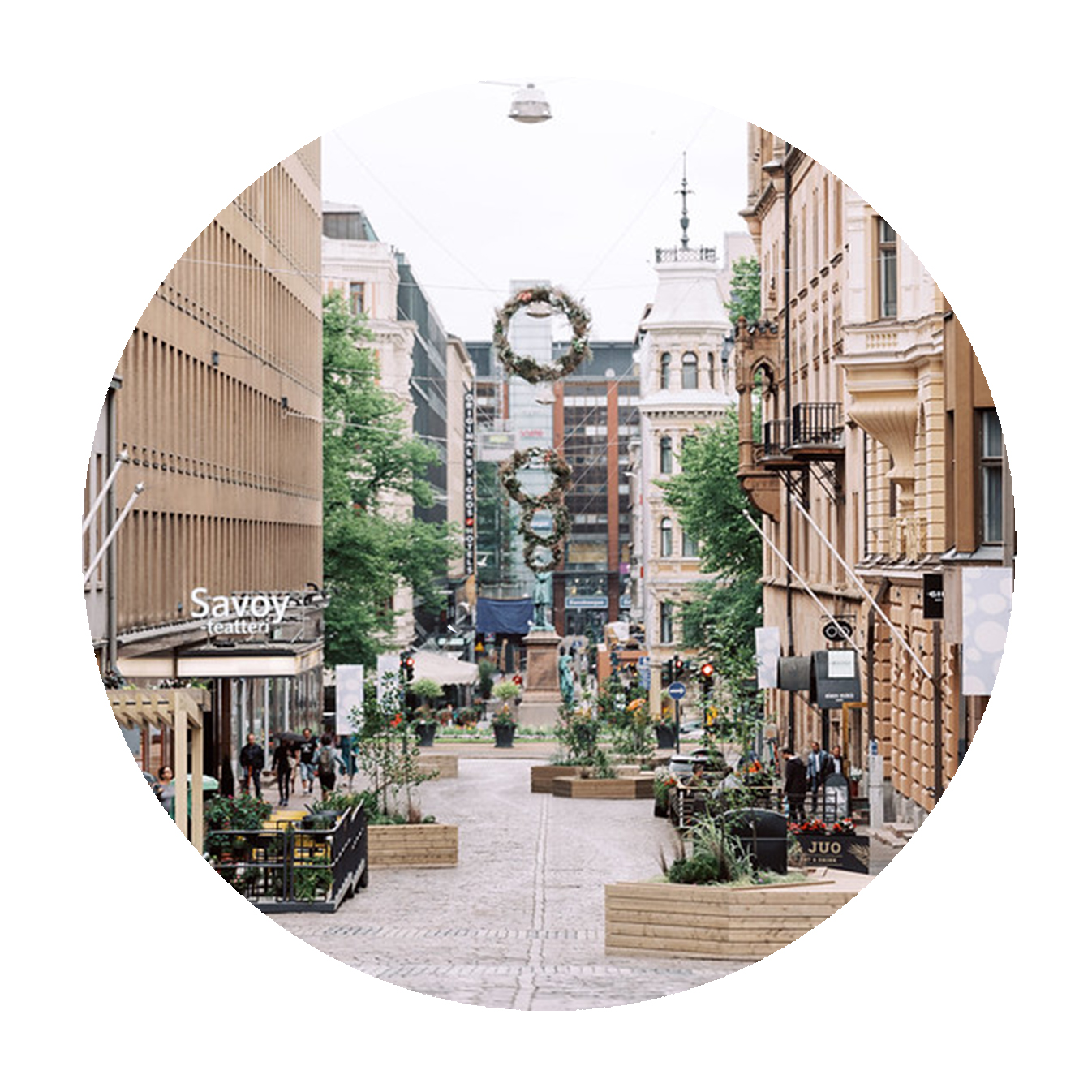
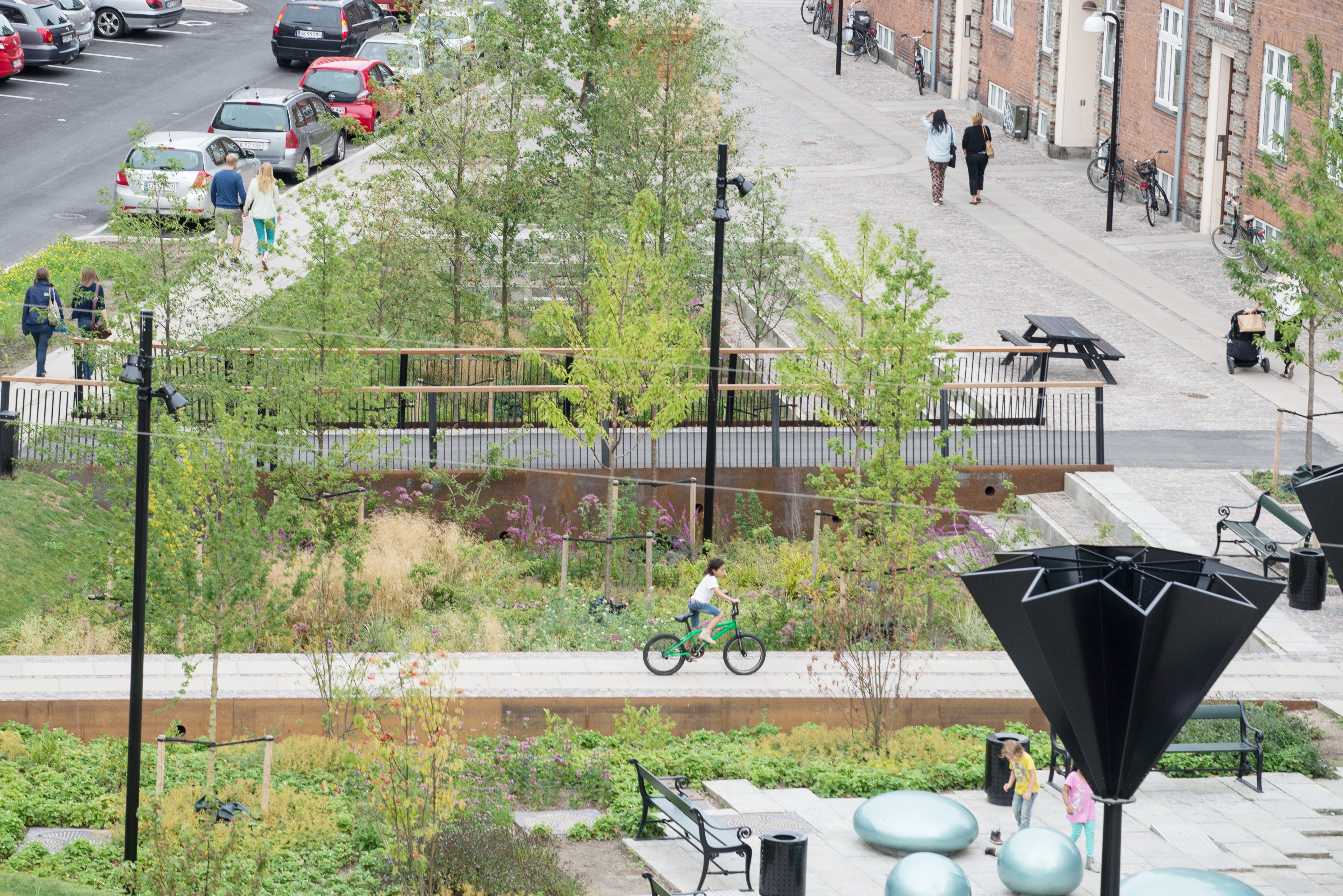
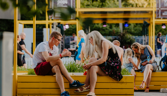
The Solution: Managing rainwater runoff while creating a green heart for the neighbourhood
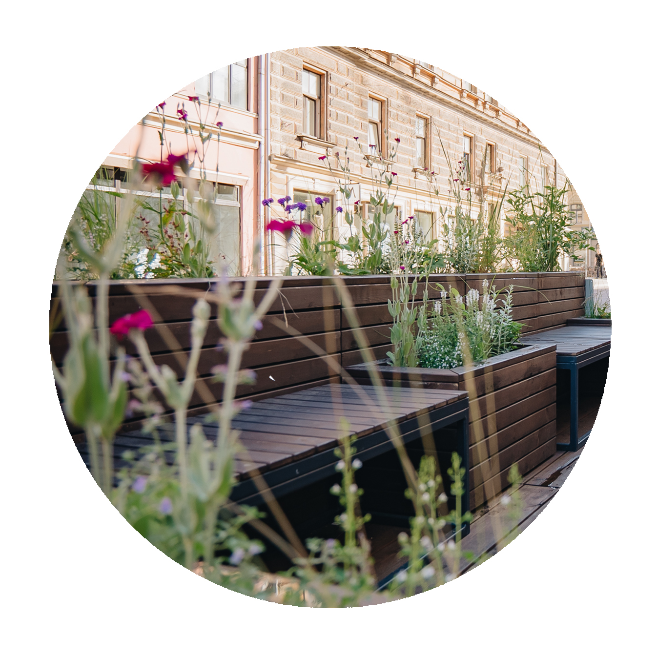
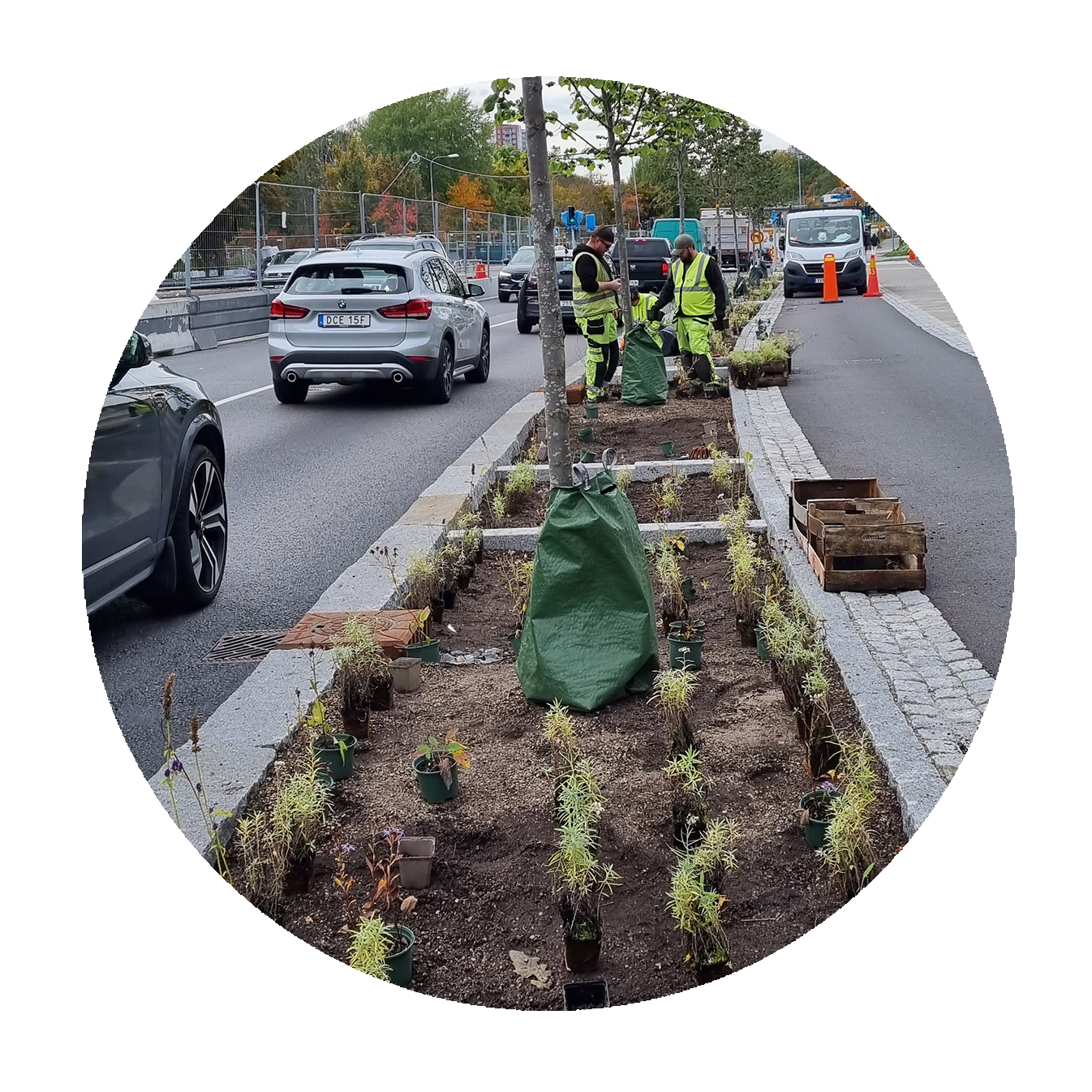
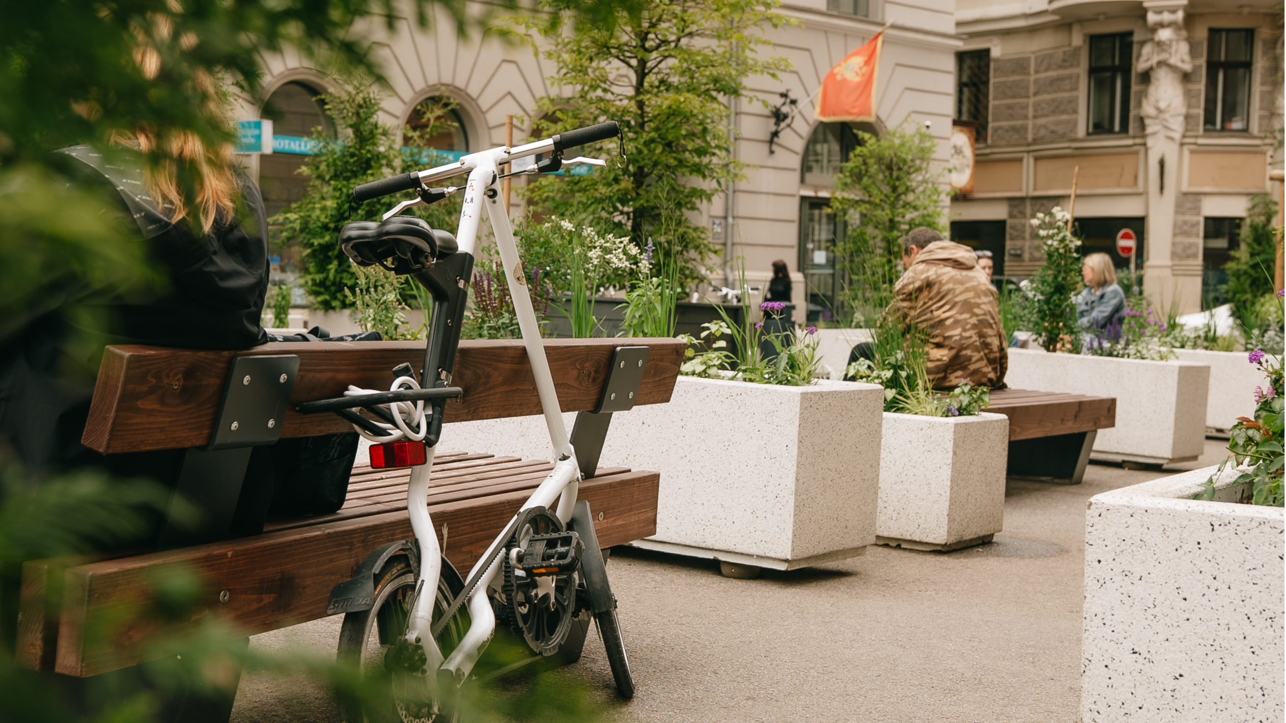
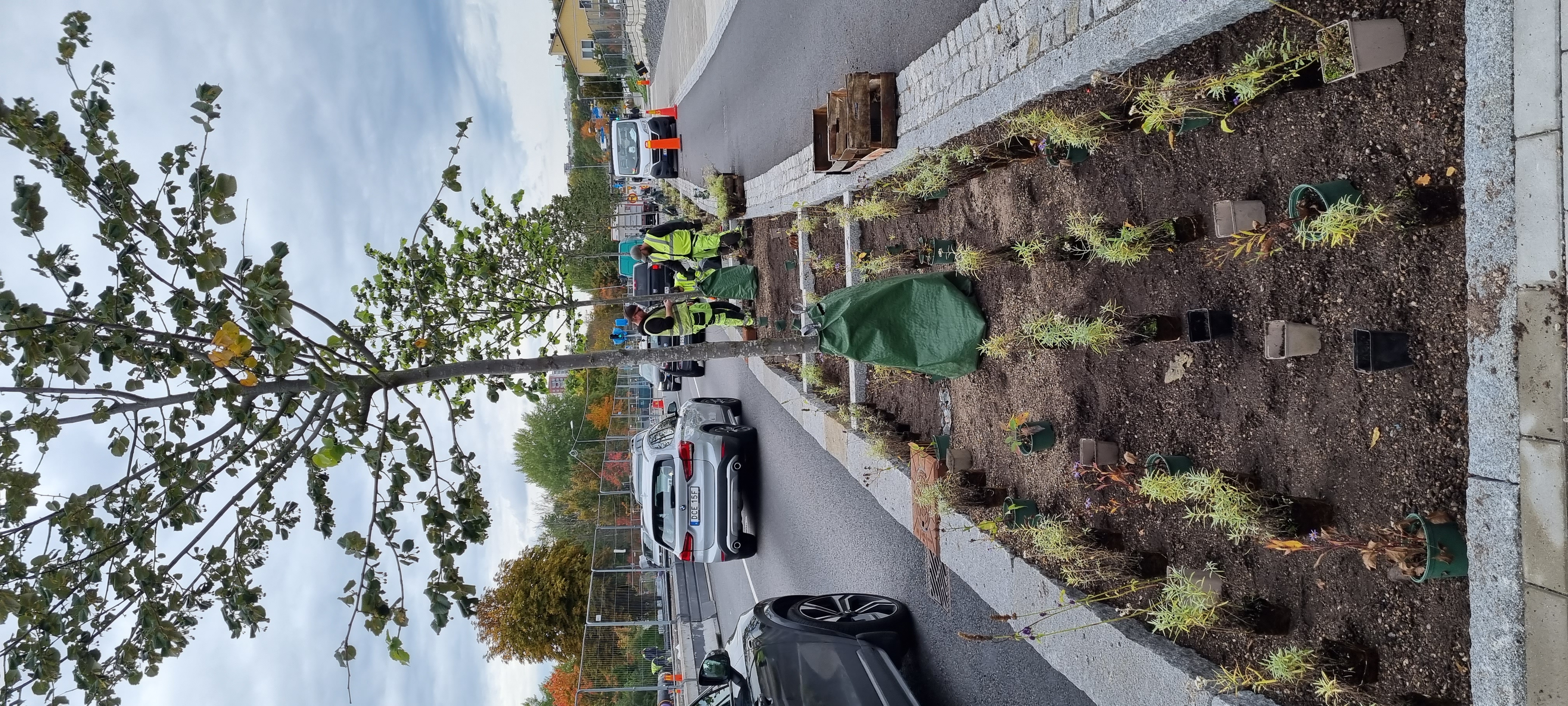
In the neighbourhood of Østerbro, Sankt Kjelds Square and the street of Bryggervangen have been climate-adapted to Copenhagen’s climate-adaptation standards. During 2017-2019, the area was transformed to protect it from future precipitation and cloudbursts and can now handle both everyday rain and cloudbursts in multiple ways.
Rainwater from the road is directed to a separate pipe and then to a nearby cloudburst pipe, since this water contains harmful xenobiotics and can cause issues for blue-green solutions. The "first flush method" is used on the southern section of Bryggervangen to handle polluted road water from rainfalls. The first flush of water is treated at the local wastewater treatment plant, while the relatively clean second flush water is managed locally in the green areas.
The vision of the project was to transform Sankt Kjelds Square and Bryggervangen into the green heart of the Climate-Resilient Neighbourhood and to create an urban space that balances nature and traffic, allowing for both to co-exist.
With around 15,300 m2 of road area, the area previously had no nearby places for residents to meet or walk. The road area has now been optimised to 5,600 m2, ensuring mobility efficiency while transforming the rest of the area into green space for locals to stroll and enjoy the sound of birds.
The Bonus Info: Two-phased citizen engagement
The efforts to involve local citizens can be divided into two main phases.
The first phase from 2011 to 2014: During this phase, meetings with local residents collected information using question sheets. This was later analysed during several workshops by competing project groups. Suggestions from residents included:
- More traffic safety and less heavy traffic
- More green areas and breathing zones
- Room for both play and relaxation
- Keep the parking spaces
The second phase from 2015 to 2018: The phase began with a public presentation of the winning project and team. Then a follow-up group was set up to provide feedback on the drawings and project description. Citizens were involved in planting trees and vegetation in the final stage of the project, an initiative called “earth under your nails."
Nacka: Screen basins and sun decks to manage stormwater and rapid urbanisation
Keywords: Stormwater management, pollution reduction, accessibility & inclusivity, public space, people-centred design, ecosystem services
The Challenge: Rapid urbanisation puts pressure on stormwater management and disturbs the natural environment
The municipality of Nacka is located between central Stockholm and the Stockholm archipelago, providing not only urban life, but also a beautiful natural landscape attracting a lot of people. The municipality consists of a group of islands connected by bridges and surrounded by lakes and waterways.
The existing developments in the municipality lack proper stormwater treatment, resulting in insufficient water quality in the receiving lake, Järlasjön, which is in violation of the European Water Framework Directive.
As Nacka’s rapid urbanisation puts even higher pressure on the stormwater management, increased pollution is expected in Järlasjön. The lake also lacks space on land for end-of-pipe stormwater solutions, and nearby roads cause noise and an unpleasant environment, despite the lake’s scenic beauty.
Additionally, the inaccessibility of the lake, the overgrown shoreline and the lack of local urban parks and bathing places contribute to making the environment unpleasant, despite the fact that the natural landscape is one of the reasons that inhabitants choose to live in Nacka.
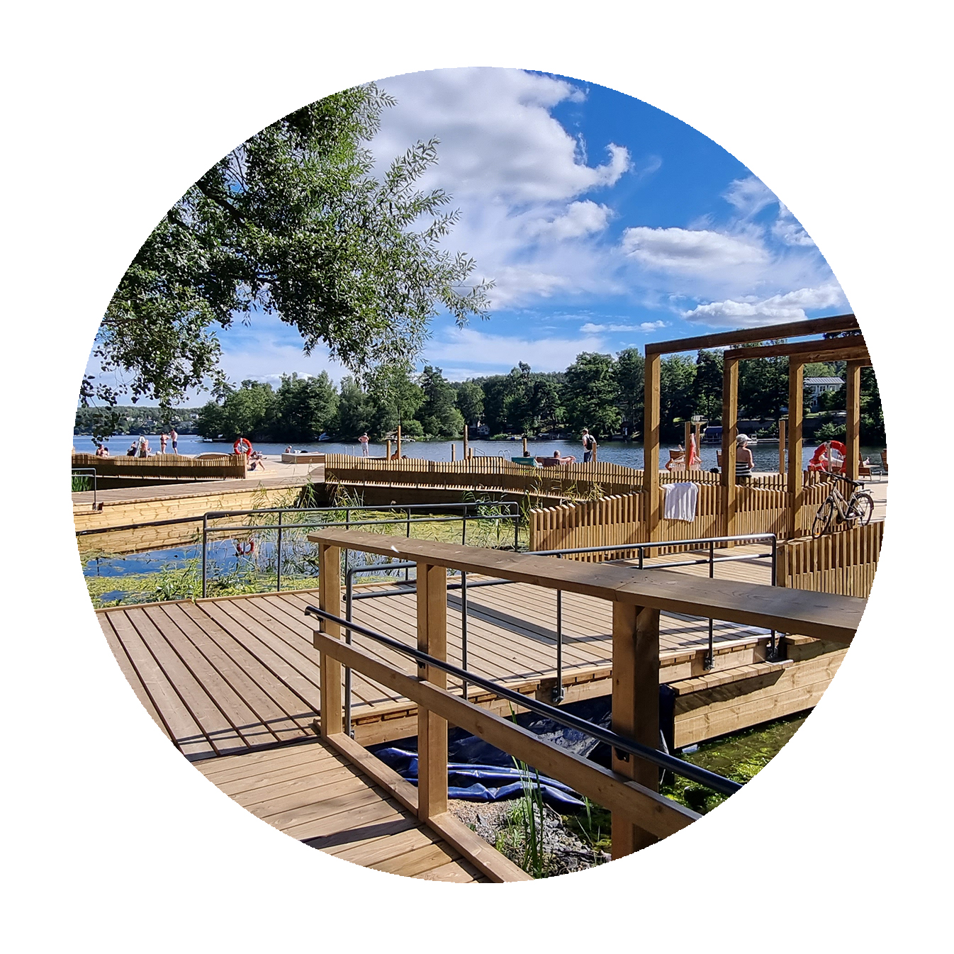
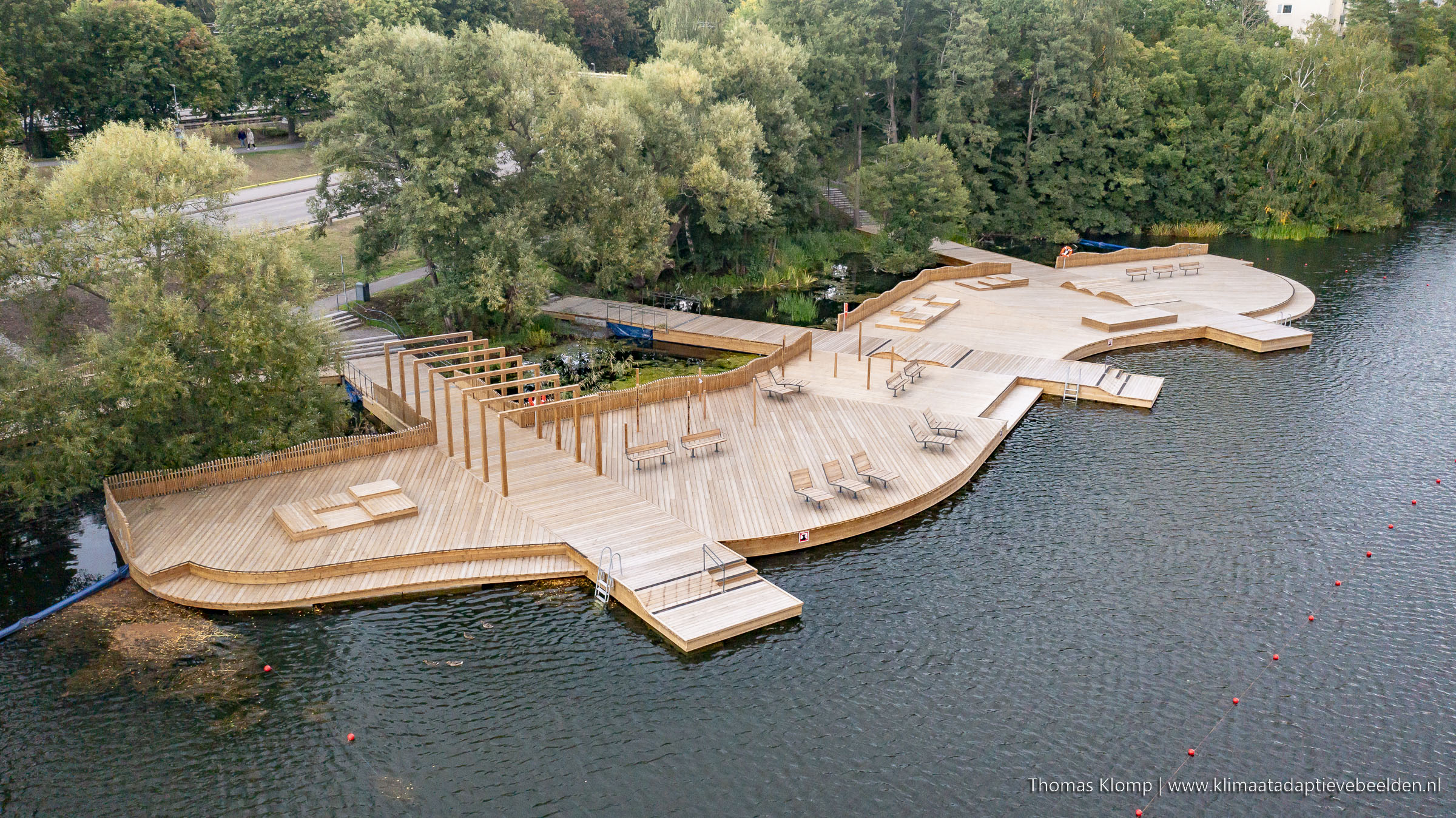
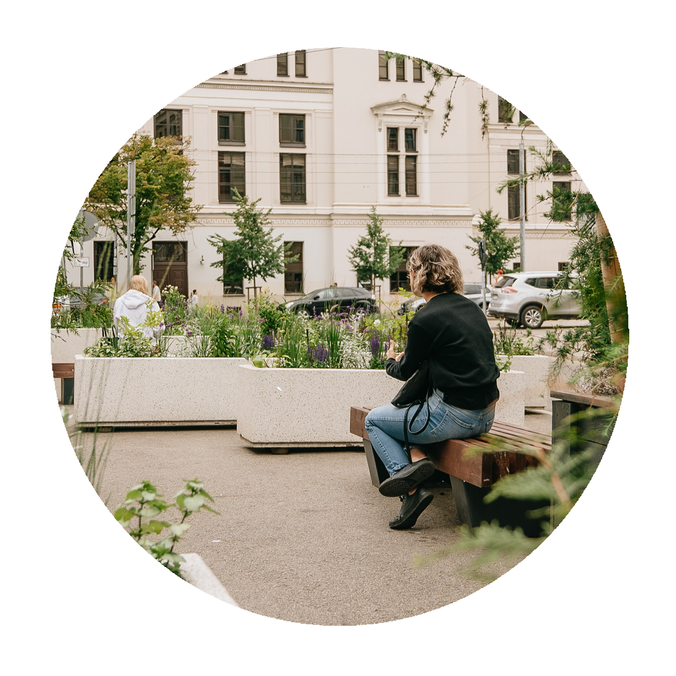
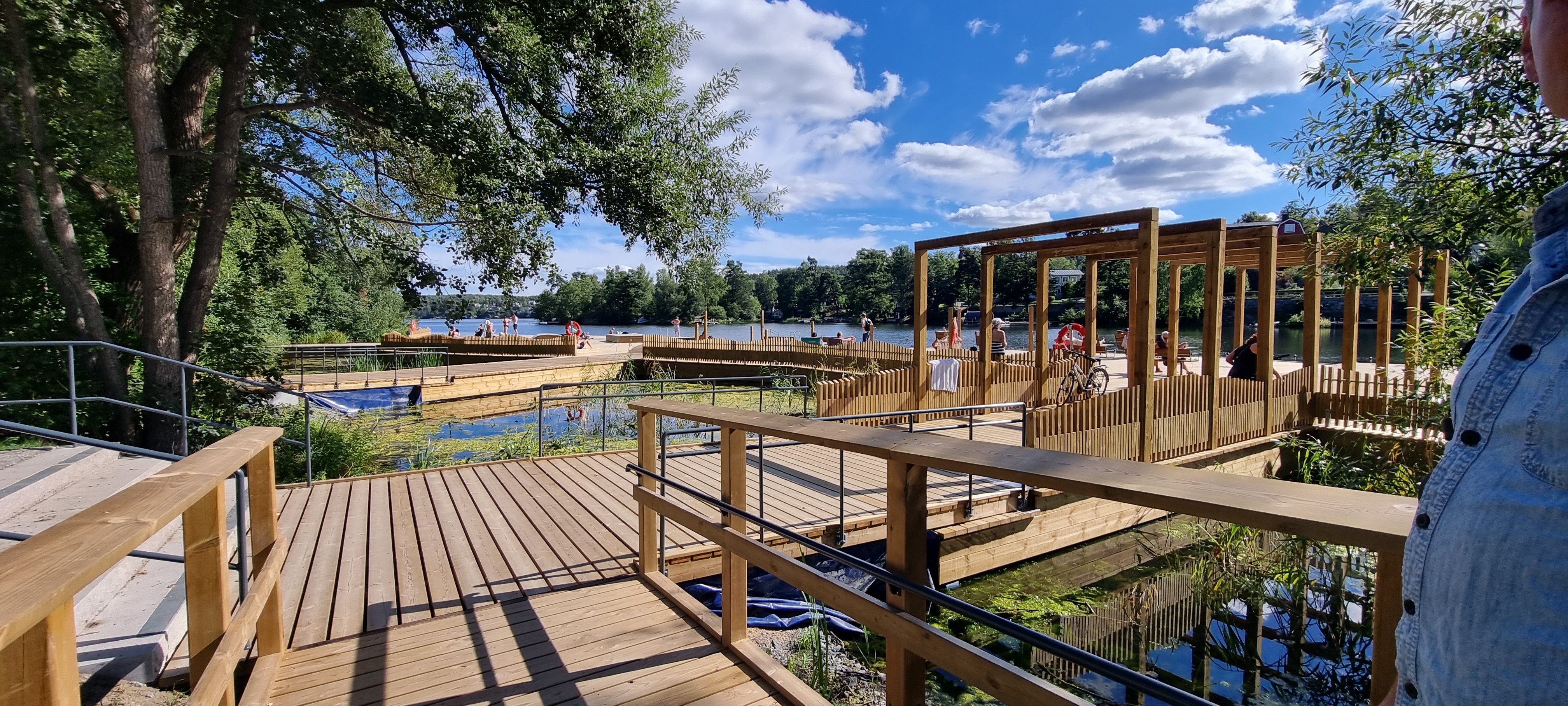
The Solution: Enabling nature-based stormwater management in tune with people and planet
To address the increasing water pollution and contamination in Järlasjön, a 3,000 m2 screen basin was proposed, which treats polluted stormwater through controlled sedimentation, utilising nature-based solutions to improve water quality.
Meanwhile, the shoreline and contact with the water have been made more accessible for all citizens. New sun decks have been constructed, offering opportunities for bathing, and a new urban park environment was created, all of which enhance the area’s natural beauty and recreational value. To increase accessibility and line of sight, the vegetation has been thinned.
The project also includes the connection of nearby pedestrian and bicycle paths, promoting sustainable travel and making the area more accessible. Furthermore, a nearby road is being redesigned and dimensioned for lower motor-vehicle speed to prioritise sustainable travel demands and reduce noise pollution. With these measures, the project aims to provide a sustainable and enjoyable environment for residents and visitors alike.
To achieve all of this, it was necessary to seek close and integrated collaboration between politicians, consultants, municipal technicians and operation and maintenance personnel during the planning and design process. Close collaboration between different infrastructure projects helped meet various needs and achieve common goals, resulting in a better overall outcome. The early inclusion of future travel patterns and stormwater management needs in the overall urban planning process will have a significant impact on the local environment.
The Bonus Info: Combining different infrastructure projects for common goals
This case study shows that even a water treatment project can be used to create a public space that is widely used by citizens and brings them happiness through better access to the water. Overall, the project will ensure a more sustainable and enjoyable environment for residents and visitors.
The project also shows the benefits of collaboration between different infrastructure projects for common goals that may give space for visitors and citizens to use their environment more efficiently and ensure a better quality of life. The synergy between life quality and function shows an attitude that can be applied everywhere. Citizens demand life quality everywhere and, if taking that demand seriously, even a technicality such as water treatment can be used to improve the urban environment.
Helsinki: Summer Streets pave the way towards permanent change
Keywords: Living streets, walkable streets, resting areas, summer streets, placemaking, temporary activities, temporary urbanism, pilot project
The Solution: Temporary slow streets promote a sustainable and vibrant urban environment
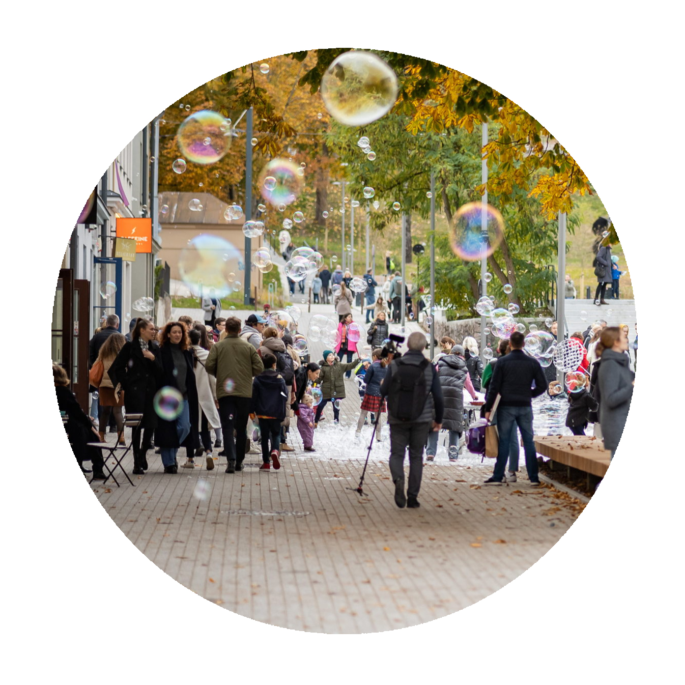
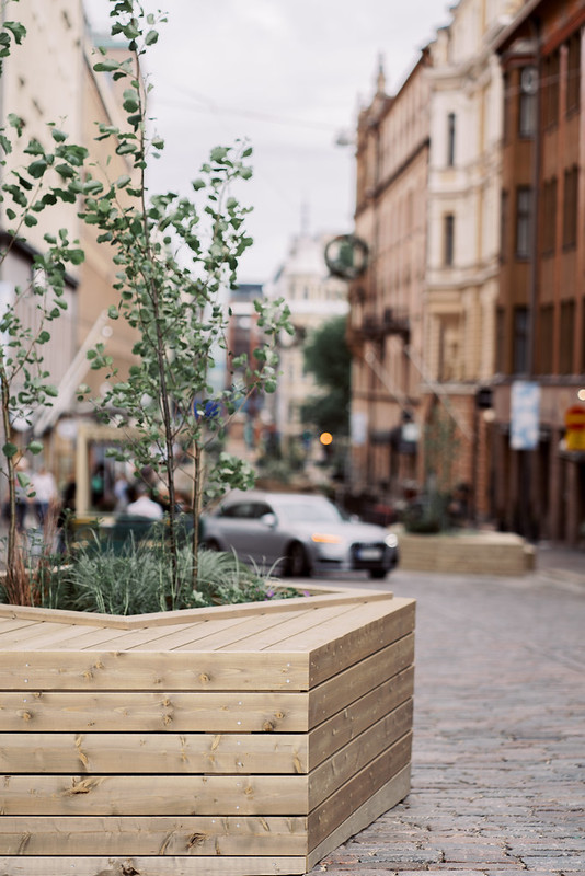
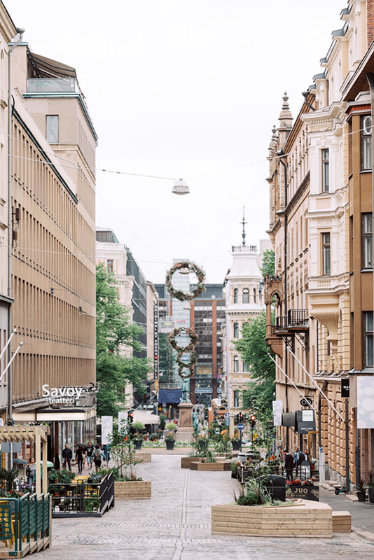
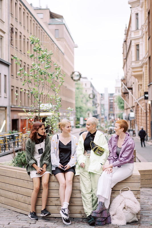
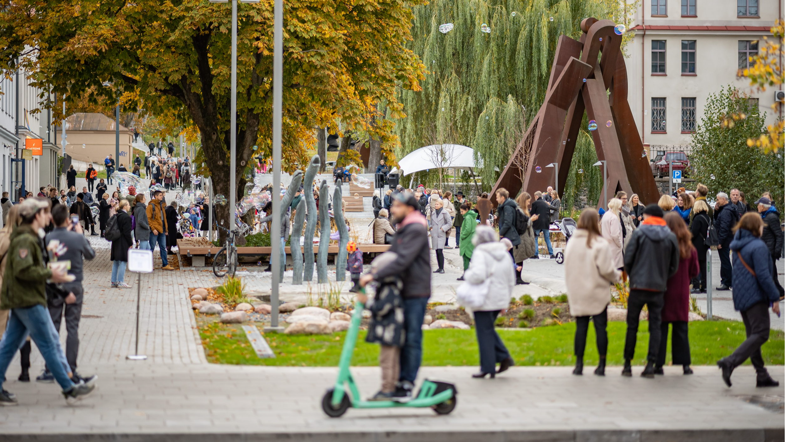
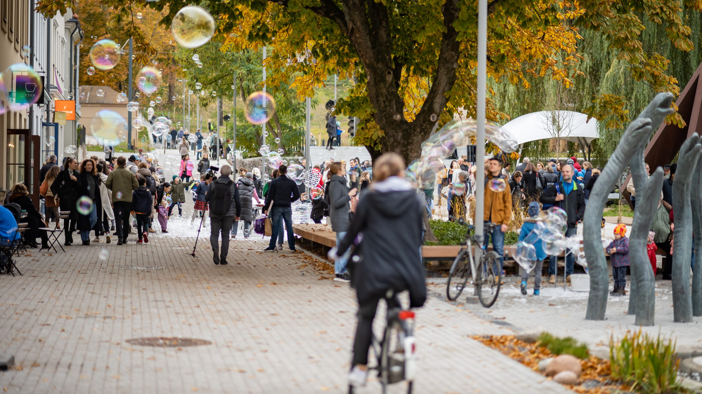
In the summer of 2021, a pilot programme was launched in Helsinki to turn two streets, Kasarmikatu and Pohjoinen Makasiinikatu, into temporary slow streets in woonerf style. These “summer streets” included street furniture, wooden islets, lush greenery, parklet terraces set up by local restaurants and other traffic-calming measures. The two streets were connected to the Esplanadi park and the city centre, and an additional “summer terrace” was set up on the Kasarmitori square with 12 restaurants and 560 seats, helping create a vibrant atmosphere in the city.

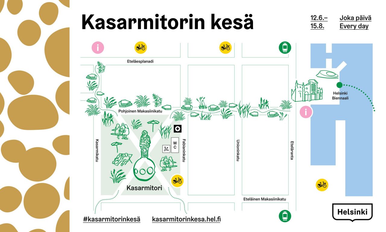
The aim of this “summer streets” project was to make Helsinki’s streets a more attractive place for people to spend time and take part in urban life during the summer season, while encouraging walking and cycling in the city. In 2022, the popular programme was expanded to four more streets near the city centre. Since then, the city has decided to evaluate whether each successful summer street can become a permanent fixture.
Introducing several new features to create a more sustainable, comfortable and enjoyable urban environment for everyone, the programme put a strong emphasis on urban greenery such as plants and trees, which not only enhance the profile of a street, but also provide cool places to rest during a hot summer day. Inspiration was taken from Finnish nature, especially the archipelago of Helsinki, whose islets provide a relaxing space for people to gather, unwind and take in the summer atmosphere.
To ensure the safety and comfort of pedestrians and cyclists, car traffic was calmed by placing the street furniture in a non-linear sequence, narrowing the space for cars and creating curves, which encourages lower speeds and reduces the streets’ attractiveness for through traffic. The street furniture was built from high-quality Finnish wood, connecting materiality to the local heritage, the local wood industry, and giving a sense of place-specific identity.
The process included open online events for citizens and local business owners as a way for interaction and engagement processes during the COVID-19 pandemic.
Helsinki summer street, photo by Camilla Bloom
The Bonus Info: Positive public response demonstrate support for improving walkability
The “summer streets” programme provided pedestrian-friendly space to residents, local businesses, restaurant owners, museum owners and children and was positively received by the public, with many businesses reporting positive effects on their sales and people expressing a desire for similar projects in the future.
In 2021, the number of pedestrians on Kasarmikatu rose by 45% compared to before the pilot programme, notably thanks to the summer terrace on the Kasarmitori square, which attracted a lot of people to the area. That year, almost all the business owners were satisfied with both the summer streets and the summer terrace on Kasarmitori.
In 2022, when there was no summer terrace on the square, only the summer streets, a little over half of the businesses were pleased, while the rest were concerned about reduced on-street parking and planning details. However, many businesses reported that the summer streets had a positive effect on their sales.
In 2022, the City of Helsinki made an open survey that attracted about 950 respondents from different age groups, genders and neighbourhoods in Helsinki, with a car ownership rate in line with the overall statistics. According to the survey, 85% of the respondents wished that the city would realise walkability pilots like the summer streets again, while 61% of the respondents would be ready to replace space for parking cars with permanent elements that improve walkability. 65% said they would be ready to limit through traffic permanently if it improves the walkability of the urban space.
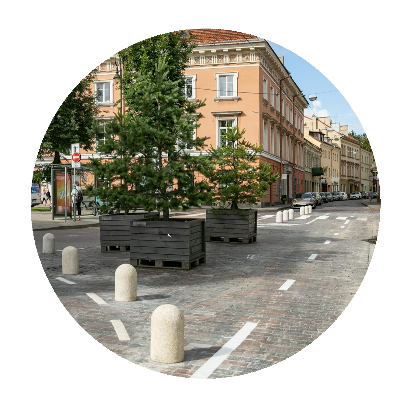
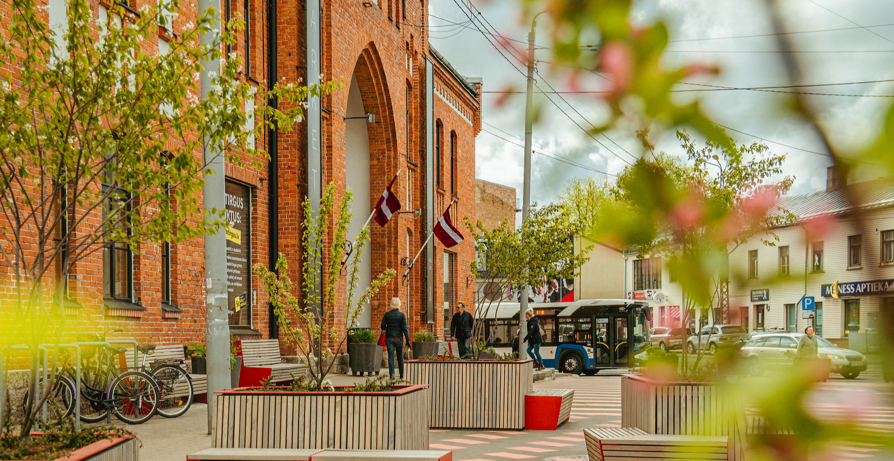
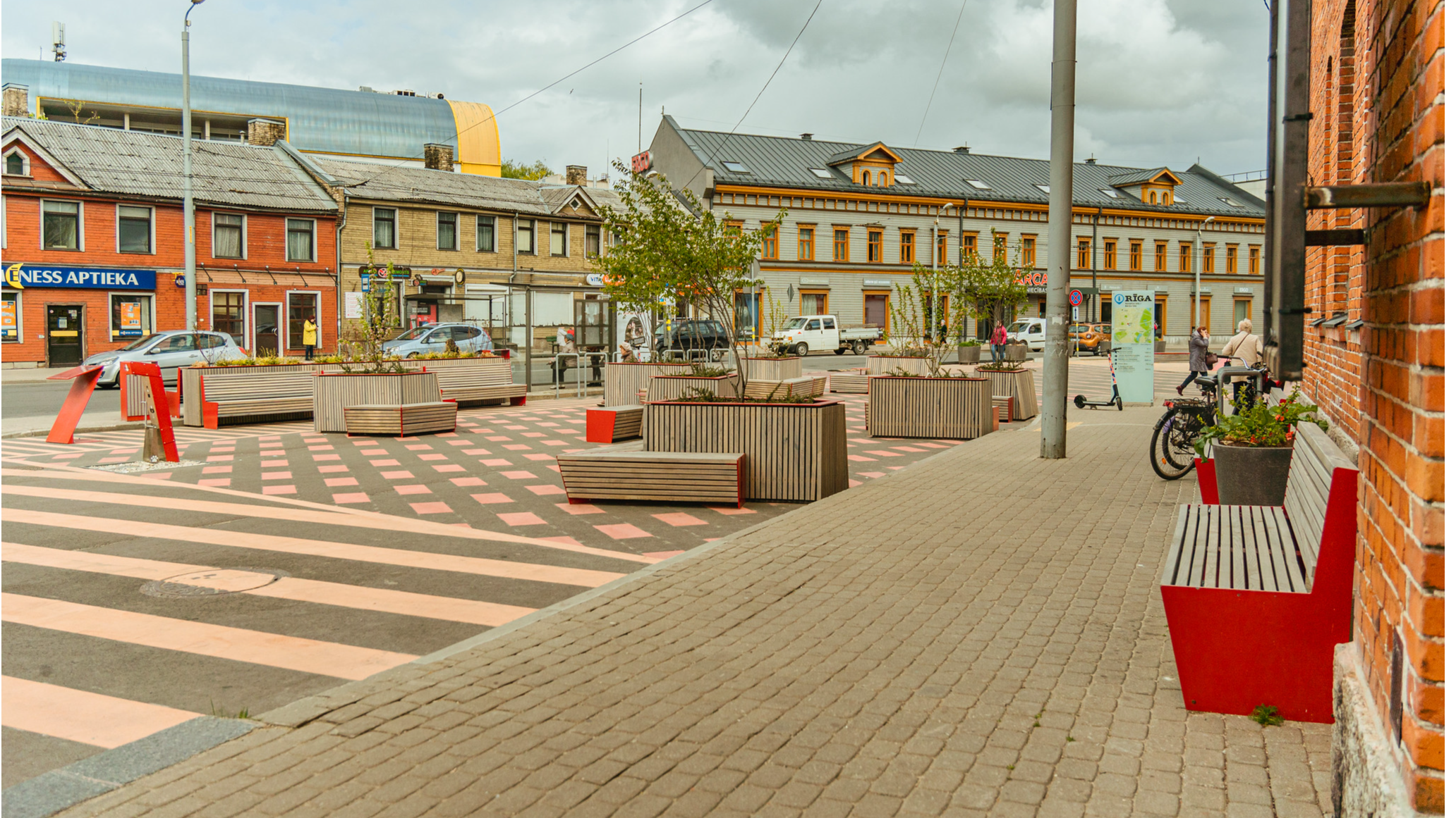
Riga: Transforming a parking lot back into a theatre square
Keywords: creating public realm, urban greenery, pollution reduction, incremental change
The Challenge: Addressing a lack of green spaces in Riga
The lack of green spaces in Riga’s city centre and the quality of public space is often mentioned by residents as one of the main things they would want to improve in the city. However, planting new trees and greenery in Riga is challenging, especially in the city centre, where creating new green spaces can take a lot of time and demand a lot of resources.
Meanwhile, until 2021, Riga’s Theatre Square had become an illegal parking lot and a dead space next to the Latvian National Opera on the edge of Old Town.

The Solution: Transforming Theatre Square into a green oasis in the heart of the city
Theatre Square has been transformed into a peaceful and green meeting spot where residents and visitors of the city can enjoy a peaceful moment in the middle of the city.
In 2021, the parking lot became a pop-up green space for the summer, which proved to be a massive improvement to the city centre. To transform the square quickly and at lower costs, the Municipality chose to deploy mobile benches and potted plants.
In summer 2022, the square became a fixed green space in the city, and more benches and potted plants were added. With residents seeing the transformation as a positive change, the square is set to be rebuilt into a fixed green public space, no longer functioning as an illegal parking lot.
The Bonus Info: Quick and cost-efficient solutions prompt demands for more changes
The initiative proved how the city can reclaim public space from cars with cost-effective and relatively quick solutions. It also shows that, in order to make change, large solutions are not always as efficient as small, incremental changes. These may give citizens the real experience of improved quality of life, eventually leading to demands for the changes to become permanent or to spread to more places across the city.
In this case, the citizens’ right to use Theatre Square as a place for public life has been successfully reinstated.
Helsingborg: Portable parks as a flexible solution to green the city
Keywords: public environment, urban planning, portable park, climate, trees
The Challenge: A flexible approach for building the sustainable city
Helsingborg has ambitious plans to transform into a more sustainable city that is also both a liveable and an attractive place for its residents. To do so quickly and cost-efficiently, Helsingborg has been testing flexible solutions to create resilience for the sometimes unknown needs of the citizens. By integrating "new learning as we go," the city gathers citizen input at an early stage before (expensive) permanent decisions are made.
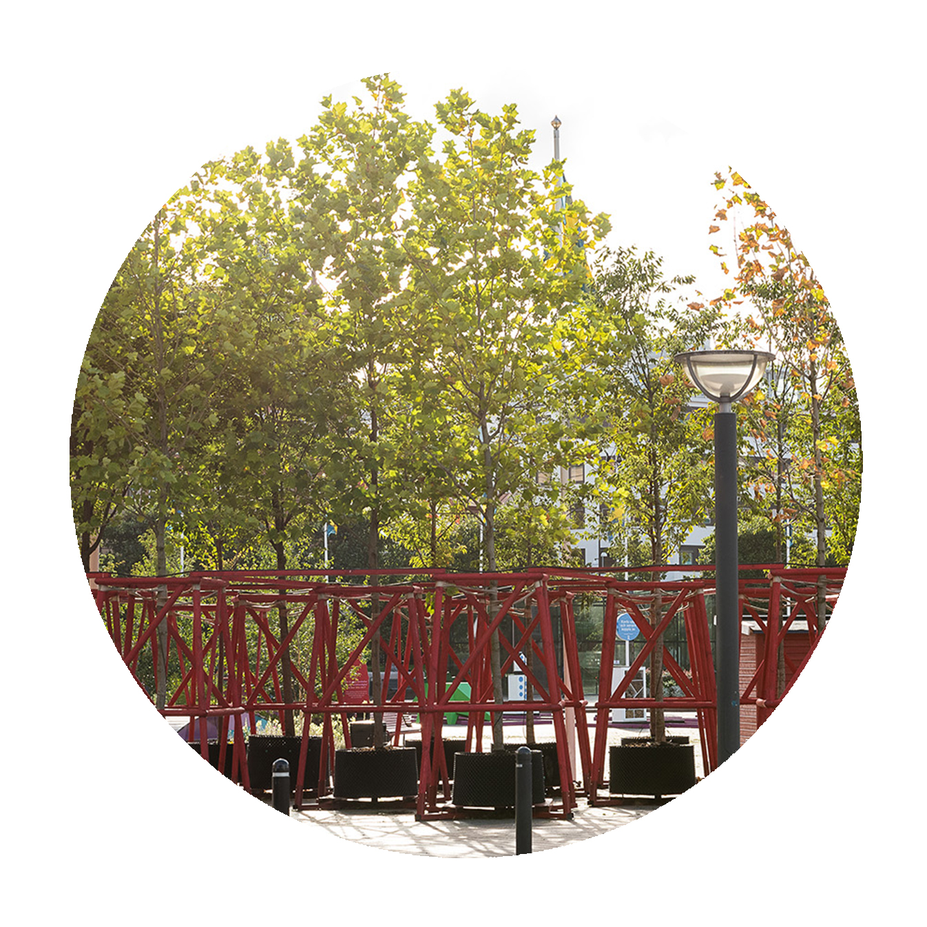
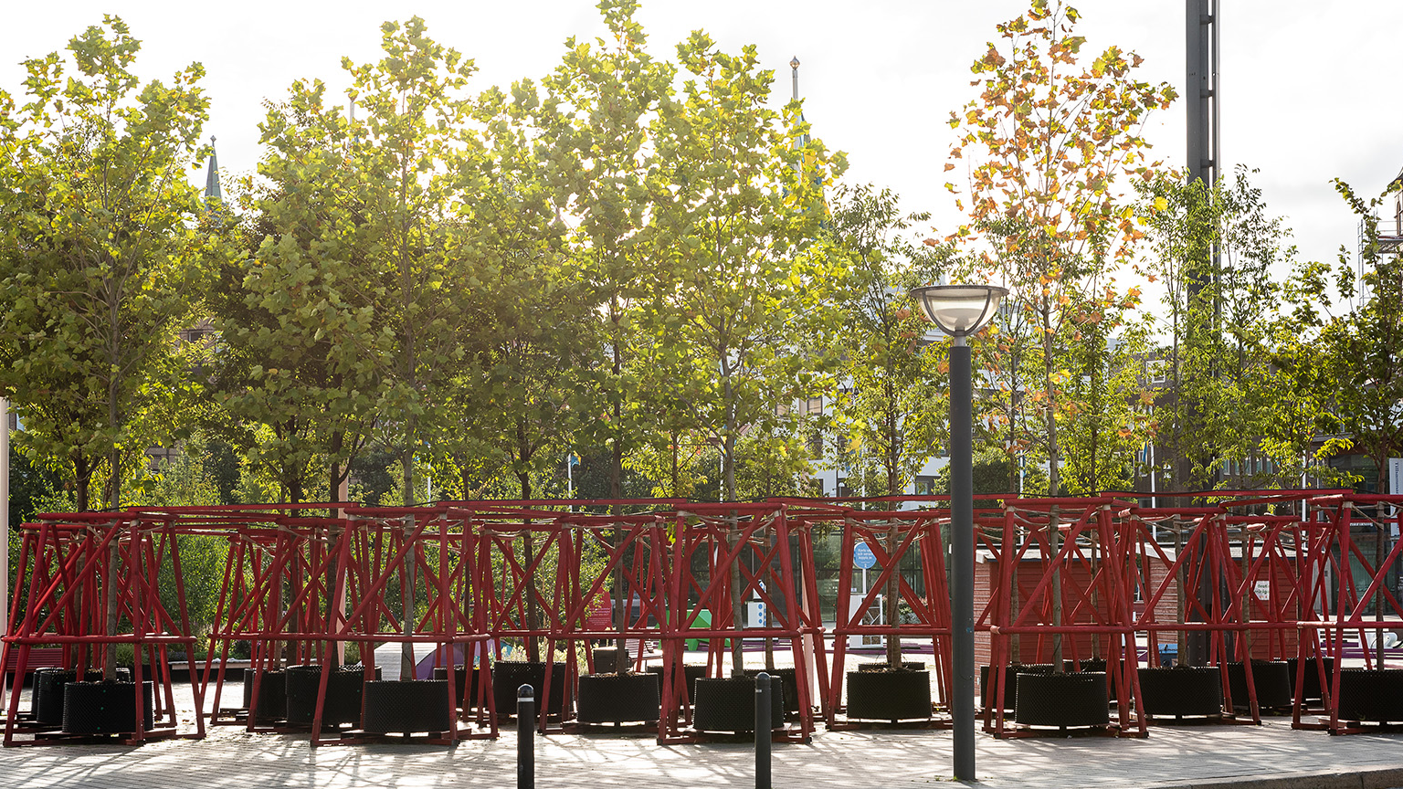
The Solution: Enhancing urban greenery by nurturing trees in a portable park
One of these flexible solutions has been to create a temporary urban park by building a plant nursery in the middle of the city. Since autumn 2021, three hundred trees have been placed in red wooden stands in eighteen different locations in the centre of Helsingborg, most of them in squares and central avenues to fill in the gaps left by horse chestnuts previously removed due to chestnut haemophilia.
The city took an innovative approach by purchasing trees that were around 10 years old and already five to seven metres tall, and letting them continue their growth in the urban environment instead of a nursery. The varieties of hardy trees include berry elm, mountain cherry, ornamental cherry, pagoda tree and freeman maple, all of which are well-suited for urban environments.
This "Portable Park" project added greenery in public spaces in the city centre that otherwise would have no trees. In addition to promoting a better climate and richer biodiversity, the people of Helsingborg enjoyed the greenery and the beautiful seasonal variations.
The Bonus Info: The project continues
By spring 2023, all of the trees in the portable park have been planted permanently in more than sixty different locations in Helsingborg. It was crucial at an early stage to involve residents as well as relevant companies and organisations to help set the objectives of the project and locate suitable areas for the trees.
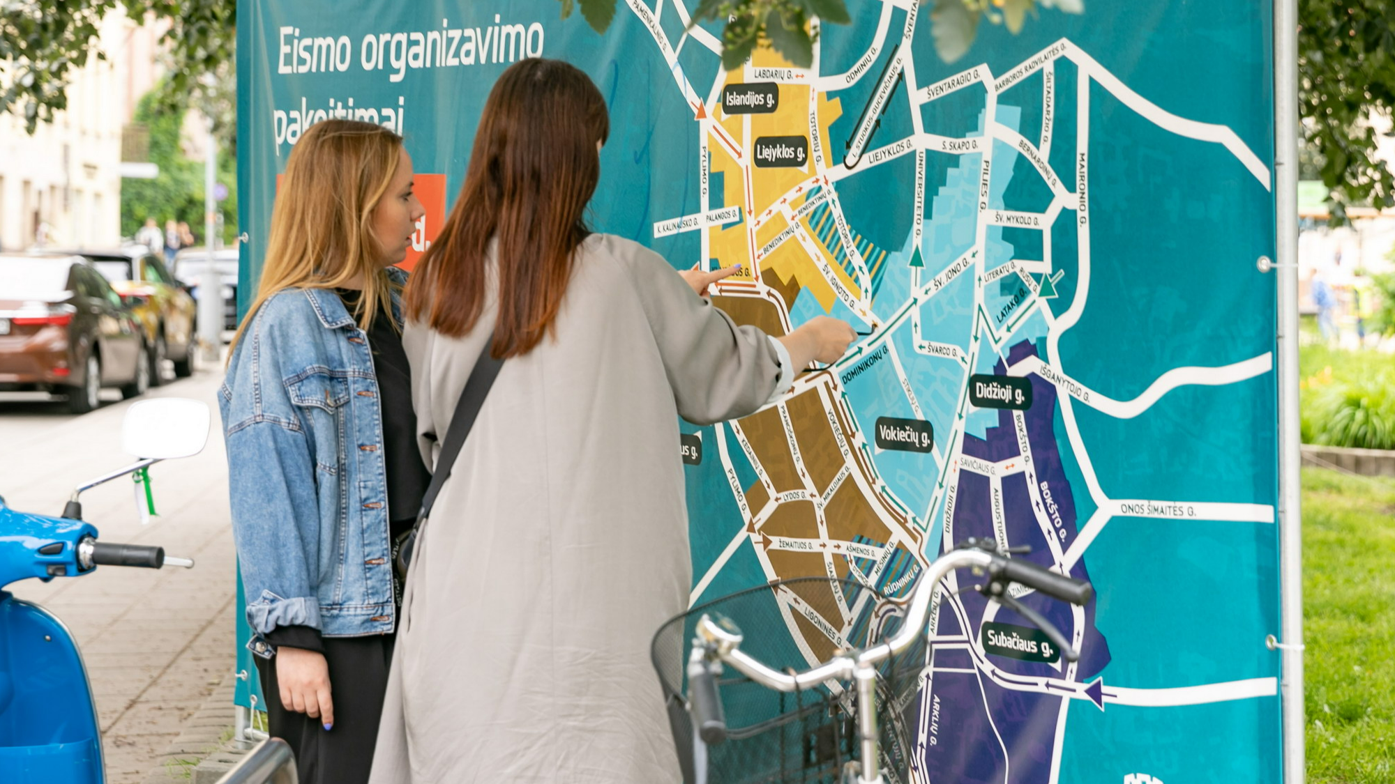
Vilnius: From car focus to society focus
Keywords: pedestrianised street, pay on the way, heritage, public space, open air art gallery
The Challenge: Car dominance hindering the potential of a natural gathering place
Known for its natural springs, the site of Vingriu square and Pylimo street is located in the heart of Vilnius and served as a community well and gathering place for centuries. But rapid urban development and vehicular dominance in the early 1900s led to the springs being buried and the space transformed into a monofunctional street for vehicular circulation and parking.
The challenge of car dominance hindering quality street life, outdoor activities and safe pedestrian experiences in Vilnius needed to be addressed.

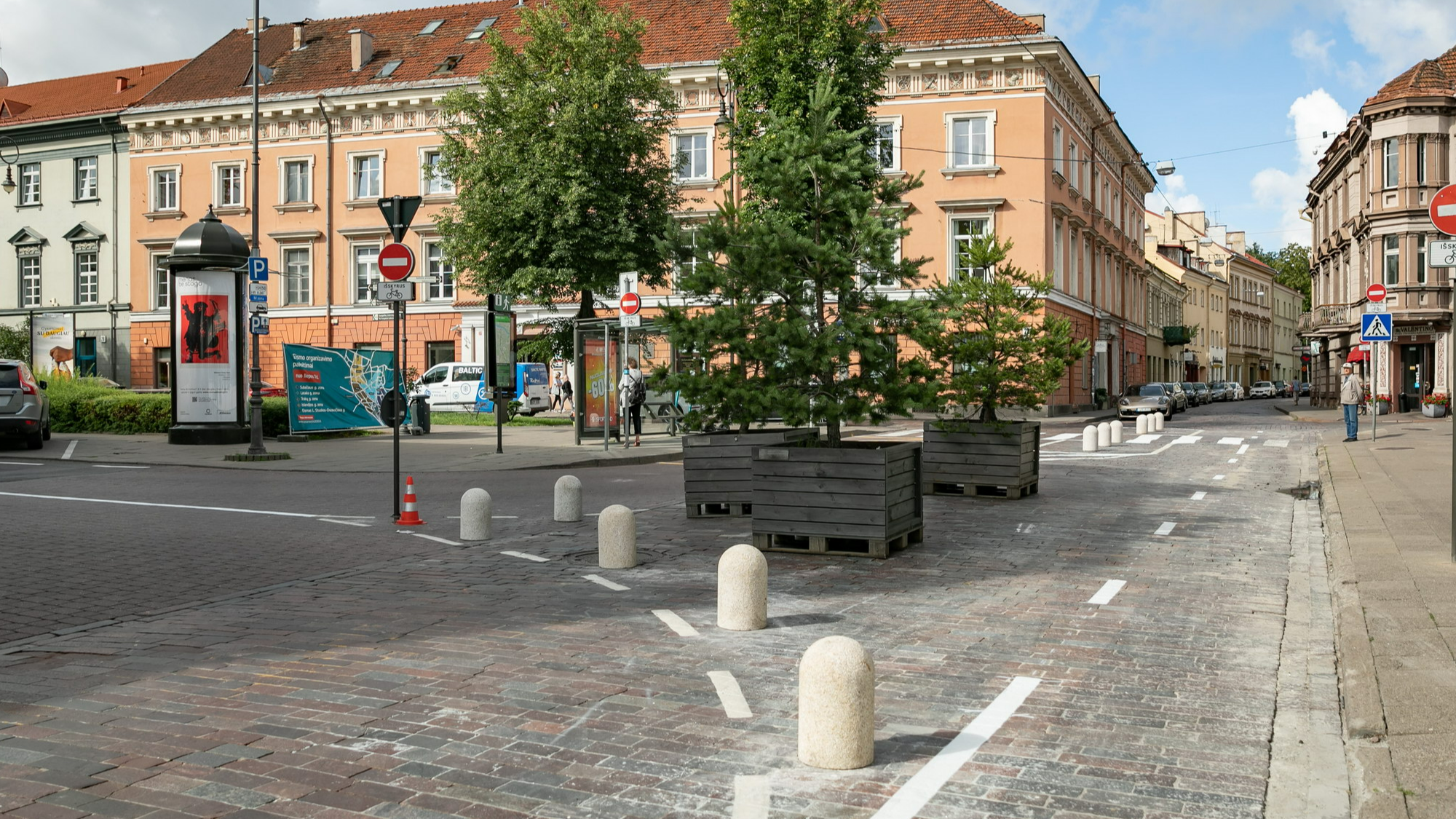
A car street opened up for pedestrians and micro mobility in Vilnius, photo by Saulius Žiūra, Vilnius City Municipality
The Solution: Transforming a neglected street into a vibrant and artful public space
In 2018, the Modern Art Museum (MO muziejus) was opened on the adjacent site, and the municipality wished to decrease motorised traffic and cars entering the town’s central area. These events catalysed a transformation of the streetscape to promote more vibrant public spaces as meeting places for the neighbourhood.
A design concept was created to reveal the buried natural springs, bringing the meandering water stream back to the surface to offer play opportunities, a tranquil atmosphere and historical significance. The site was pedestrianised, and vehicular access remains for services and emergencies only.
Designed by architects Paulius Jonys and Lolita Vileikienė, the project serves as a showcase for future streetscape regeneration projects, attracting families with kids for play and passive recreation and offering contemplative enjoyment of greenery, water and outdoor art.
Collaboration with the museum led to the extensive display of existing and newly designed sculptural pieces introduced to the wider setting as an open-air gallery. Artists found their unique ways of integrating their pieces into the streetscape and new pedestrian circulation patterns.
The Bonus Info: Art as a reflection of society
While the project was driven by the need to create a natural gathering space for the neighbourhood, the collaboration with the nearby Modern Art Museum enabled the extensive display of existing and newly designed sculptural pieces as an open-air gallery.
The power of art as a reflection of society, ideas and people gave room for a new kind of involvement and mirroring in public space. The project attracted families with children for play and passive recreation and set a higher standard for future streetscape regeneration projects in the city.
Aarhus: Mobility Points for better multimodality and active travel
Keywords: urban planning, micro mobility, mobility points, bicycle Urbanism
The Challenge: Supporting those who travel by bicycle or public transport
After years of efforts to transform its mobility system, Aarhus has experienced a significant increase in cycling due to improved infrastructure and car-traffic restrictions. However, limited parking for cargo bikes and special bicycles remains an issue in the city.
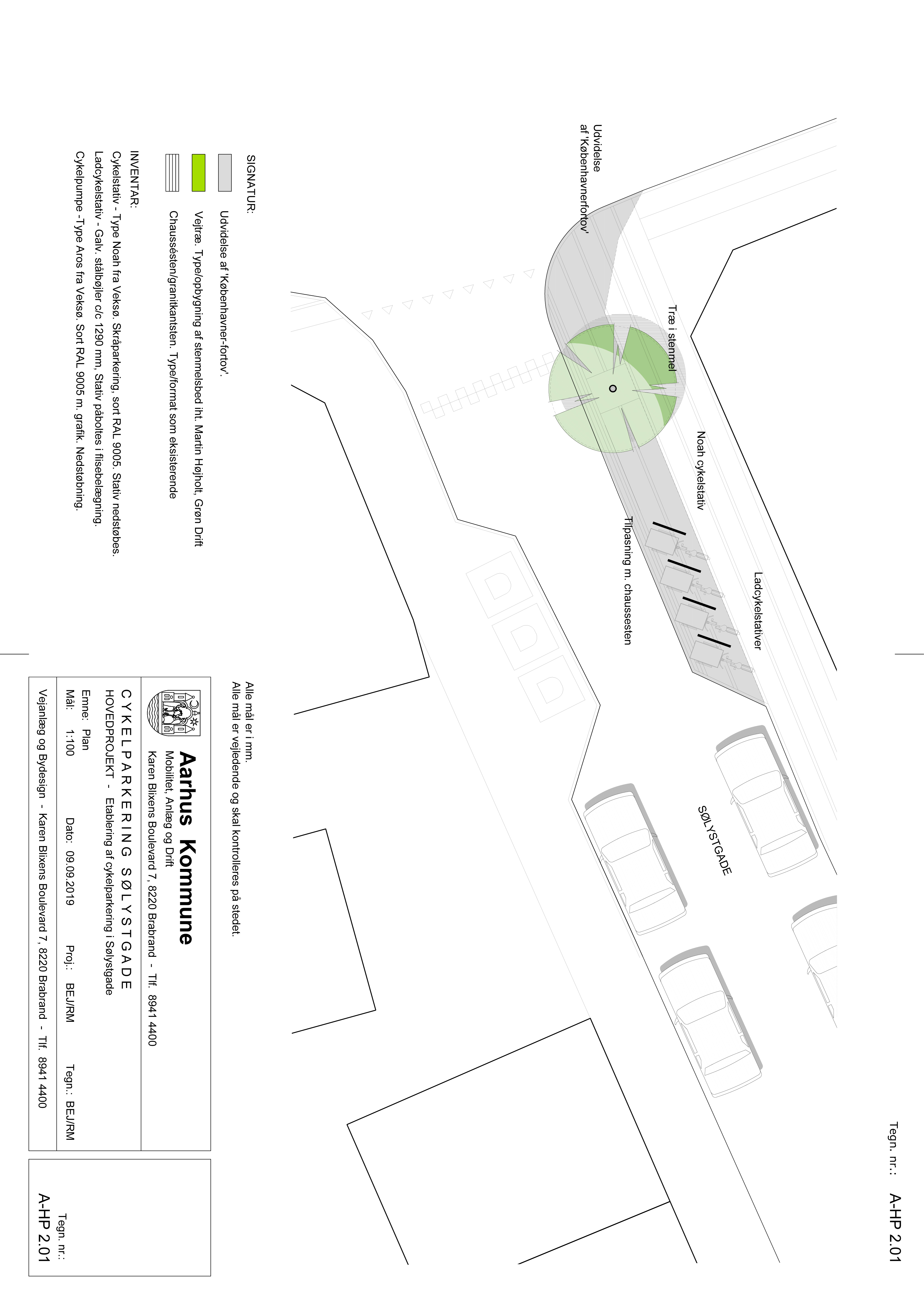
Aarhus Mobility Spot, plan sketch by City of Aarhus
The Solution: Mobility Points with trees and racks to enable better multimodality
To benefit those choosing to travel by bicycle or public transport, two Mobility Points were created near car-sharing, e-scooter-sharing and bike-sharing facilities. The aim was to encourage use of bikes and public transport by making sharing services more accessible.
The two Mobility Points include cargo bike racks and bicycle air pumps and have been highly popular since the opening in November 2019, prompting considerations for additional Mobility Points throughout the city. Trees were planted in both locations in accordance with the city's policy to plant 10,000 trees by 2025.
The Bonus Info: Engaging citizens to identify needs and locations
An essential component for the project’s success was to involve stakeholders and citizens from the beginning through workshops and mappings that helped identify challenges and solutions.
Citizen participation was crucial in identifying the need for this type of measure in the pilot area of Øgaderne and determining the exact location of the future Mobility Points, and the idea of focusing on cargo bike parking came from the citizens themselves. The success of the pilot will lead to the expansion of Mobility Points throughout the city.
Riga: Standardised parklets to create green street oases
Keywords: Creating public realm, pollution reduction, urban greenery, parklets
The Challenge: Limiting cars and supporting local businesses during COVID-19
The city centre of Riga lacked greenery and appealing public space, causing streets to be deserted places used only for parked cars, which provided very few opportunities for people to stop and enjoy city life. Breaking the habit of drivers occupying public space with private cars was a difficult challenge in Riga.
Meanwhile, the COVID-19 pandemic hit the food service industry hard, as government restrictions only allowed outdoor seating. One solution adopted in many cities was to allow the installation of temporary restaurant terraces, but narrow sidewalks and bureaucratic approval still made it hard for restaurants and cafés in Riga to survive.

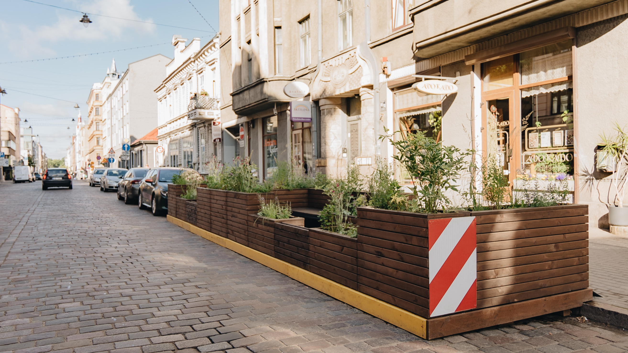
The Solution: Designing standardised parklets to help businesses reclaim public space
As a step in a new direction, Riga Municipality created a catalogue with standardised parklet designs to support local businesses during and after the COVID-19 pandemic in reclaiming public space from cars and to simplify the approval process for their installation.
In summer 2022, parklets were set up in several streets in the city centre to create green oases for residents to stop and enjoy a peaceful moment in their busy city lives, and over one third of all the outside cafés set up that summer used a standardised design from the catalogue. New designs continue to be added to the catalogue, which the municipality itself uses to reclaim public space from cars.
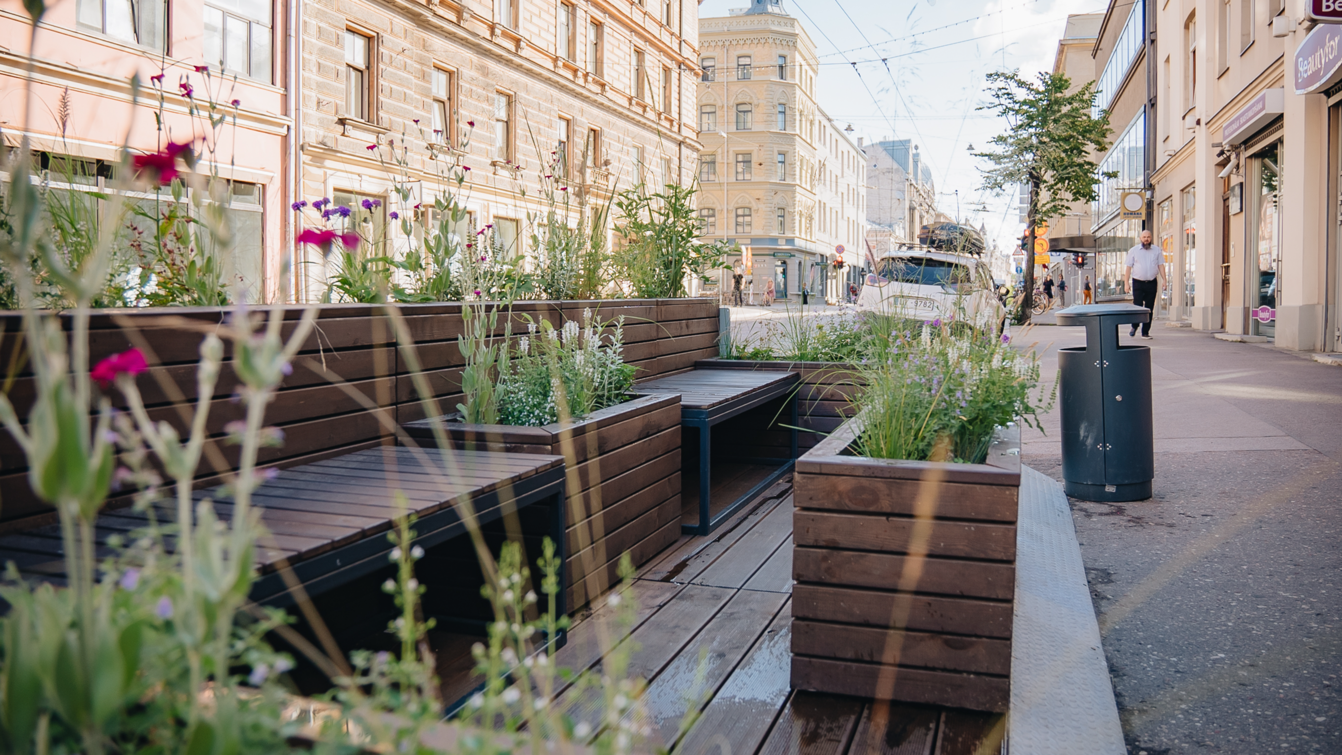
Providing small green public spaces between parking spots and evening out the space for pedestrians and cars, the parklets proved themselves to be a cost-efficient alternative for local businesses to provide space for customers, while helping communicate the wishes of citizens for a different streetscape.
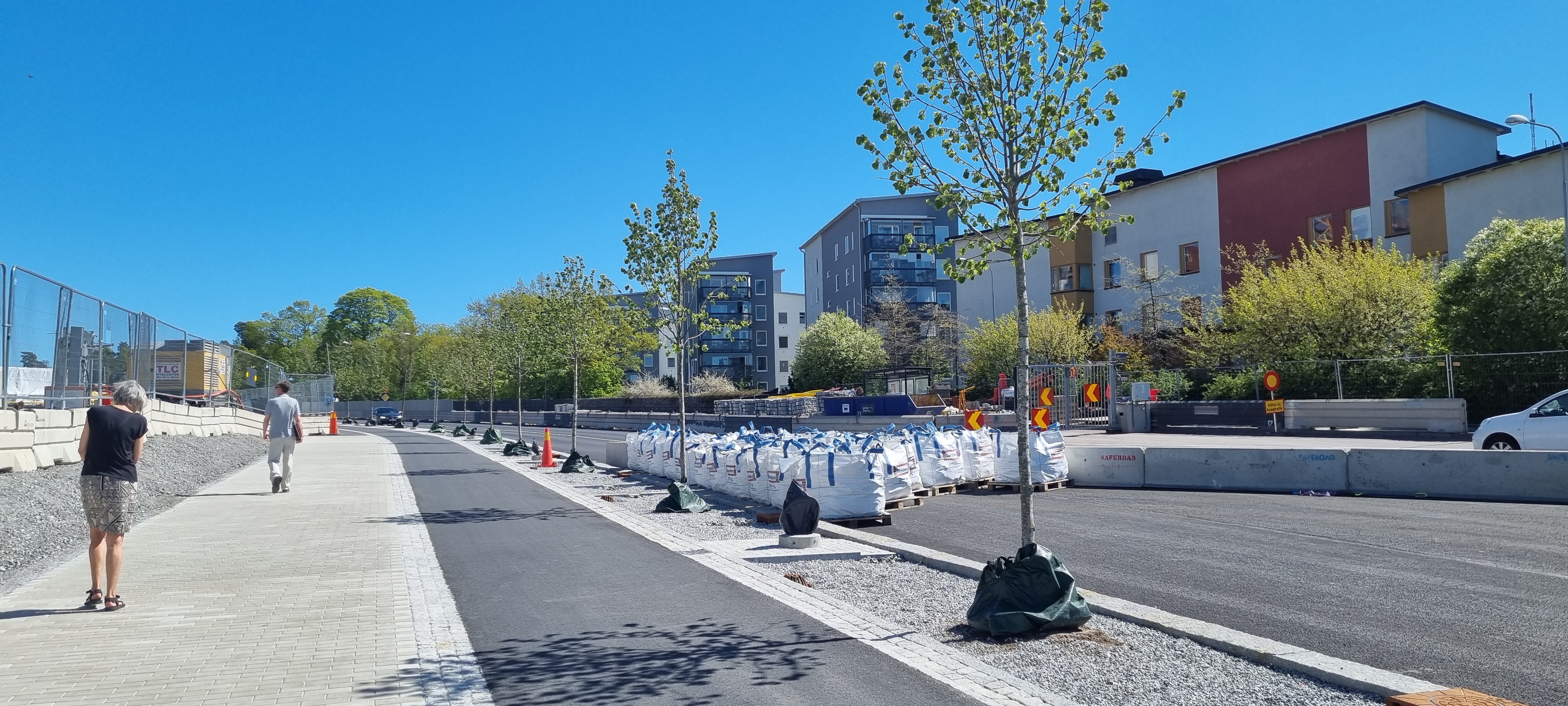
Nacka: Transforming a large road to meet a new urbanisation context
Keywords: Stormwater management, cloudburst adaptation, pollution reduction, mobility infrastructure, accessibility & inclusivity
The Challenge: A growing municipality in need of sustainable infrastructure
With 110,000 inhabitants just east of Stockholm, the city of Nacka is experiencing a wave of population growth, a typical pattern of how many sub-central municipalities of larger urban areas around the world are urbanising today.
A new subway line is being built with three new underground stations as an extension of the Stockholm metro network. As Nacka is becoming a more integrated part of Stockholm, its identity is changing. The future Nacka is not merely a fragmented urban landscape next to Stockholm, but an integrated neighbourhood with a connected street network and multifunctional public spaces.
This new context puts new demands on Värmdövägen, one of the large thoroughfares going through the municipality. The road will need a more urban character, worthy of a street in the central parts of a European capital, responding to a new context of challenges including:

- increased population
- densifying the city with new developments
- insufficient space in the road section for pedestrians, cyclists and buses
- increased travel demand
- increased traffic intensity
- high-speed motorised vehicles as a result of existing mobility solutions
- under dimensioned stormwater sewage system
- lack of cloudburst adaptation
- lack of blue-green infrastructure
- lack of stormwater treatment
- the water quality in the receiving water body is insufficient according to the European Water Framework Directive
- lack of capacity in all underground technical infrastructure.
The project is still ongoing, but the planned solutions to completely transform Värmdövägen include:
- new road width to secure all needed functions and standards
- road section dimensioned and designed (redistribution of space) for lower motor-vehicle speed in order to prioritise sustainable travel demands
- new road elevation to secure cloudburst run-off from existing and future developments
- sidewalks and bike paths on each side of the road to promote sustainable mobility in a regional perspective
- separating sidewalks and bike paths from road traffic by integrating a green vegetation zone in the road section
- reintroducing greenery by implementing blue-green infrastructure and creating good growing conditions for urban trees and vegetation
- local stormwater treatment by using nature-based solutions to improve water quality and reduce flow and volume loads downstream
- new scaled-up stormwater sewage system that will manage increased rain falls.
The Solution: Democratising mobility options and improving stormwater management
Integrating mobility, travel patterns, stormwater management and cloudburst adaptation early in the urban planning process has already had a significant impact, and collaboration between technicians, consultants and contractors was crucial throughout the design process.
The large thoroughfare has gone from a dividing and segregating road into a public space in the new urban landscape, creating ease of movement for a greater number of target groups and modes of transportation.
The Bonus Info: A multidisciplinary approach for a complex challenge
The project shows the benefits of a multidisciplinary approach in a mobility project related to rapid and complex urbanisation. Such an approach helps provide end users with better, more holistic solutions, access to their environment and better quality of life.
Tartu: Reaching climate goals through sustainable mobility planning
Keywords: Sustainable transport, clean transport, 15-minute city, strategic urban planning, governance, action plan, urban vision
The Challenge: Implementing the city’s action plan for sustainable transportation
Tartu is an academic centre and the second-largest city in Estonia. From 2003 to 2018, trips done by foot have been steadily decreasing while the use of cars has increased. While the use of bicycles has increased slowly, bus usage has fluctuated dramatically – from 25% in 2003 to 31% in 2009 and down to 21.5% in 2018.
The Climate and Energy Action Plan of the city aims to cut carbon emissions by 40% by 2030 and achieve climate neutrality by 2050, focusing on government, energy management, power consumption, housing and renewable energy production. The plan encourages more pedestrian and bicycle traffic and less private transport, with a main cycling network, mobility centres and expanded public transport services.
The Urban Master Plan complements this by upgrading neighbourhoods, making public transport carbon neutral, addressing public green space and shortening travel distances within the city. It prioritises the city centre and reduces reliance on private cars through pedestrian-friendly street redesigns, a revamped bus network and bike-sharing scheme.
The Solution: Enabling active mobility and carbon-neutral public transport while ensuring climate adaptation
A key focus for Tartu was to enhance cycling infrastructure to make active mobility more appealing. Taking concrete steps, the city rolled out a bikeshare scheme featuring electric bicycles with well-located stations determined by already existent mobility patterns, while implementing cycle and pedestrian paths throughout the city.
Another focus area was to promote public transport as a more sustainable alternative to private vehicles. With the Baltic BioGas Bus project and EU funding, the city found a way to create a new public transport system with a fleet of low-floor buses powered by locally produced biogas. After introducing 64 buses and new lines in July 2019, Tartu saw a 10.3% increase in ridership, with around 100,000 more passengers. In January 2021, the city’s public transport became carbon-neutral with biogas buses connecting to the natural carbon cycle.
While further steps are needed in the building sector to turn Tartu into a walkable, 15-minute city with mixed-use neighbourhoods, ongoing experimental efforts with car-free zones and outdoor activity areas have provided insights into the public’s future reception of such concepts. A reoccurring summer street project, for example, opens a wide street in the centre of Tartu to pedestrians and micromobility while redirecting car traffic, allowing for a variety of cultural activities and new uses to take place on the street.
By involving local residents in the decision-making process, officials are ensuring not only that changes to urban planning measures are well-received, but also that the expanded mobility options are taken up by locals.
The city has also taken several innovative initiatives such as redesigning parking lots to minimise heat islands, managing stormwater and promoting active school yards to encourage students to be more active.
By mimicking natural plant communities, Tartu’s “Curated Biodiversity” project will help green public space and make the greenery more resilient to the harsh urban environment. The Green Index evaluation method also requires private land developers to improve greenery. Since 2022, Tartu started a collaboration with the cities of Aarhus (Denmark) and Riga (Latvia) in a five-year UrbanLIFECircles project to improve liveability in locations across the city.
Car-Free Avenue, photo by Evelin Lumi
The Bonus Info: Budgets for community engagement
Participatory budgeting and active community engagement have been key success factors in Tartu’s sustainable mobility planning. First approved in 2013, the city has a policy annually to set aside 1% of the city budget for projects suggested by residents that provide solutions to practical problems.
Active community engagement projects have involved replacing an inner ring road with a 3 km linear park for pedestrians and cyclists, closing car traffic on the main arterial road during the COVID-19 pandemic to create gathering spaces, and providing temporary recreation spaces during the winter to showcase the possibilities in innovative planning.
Vilnius: Traffic loops as steps towards low-pollution zones
Keywords: car transit, intelligent traffic systems, pollution (noise & carbon) reduction, greening
The Challenge: Preserving, protecting and promoting cultural heritage
Despite the significant cultural heritage value of Vilnius’s Old Town and its archaeological area, inscribed as a UNESCO World Heritage site in 1994, the neighbourhood had long been suffering from heavy car traffic causing air and noise pollution and affecting road safety.
In 2019, transit traffic in Vilnius accounted for 49% of trips in the morning and 42% in the evening, which had a negative impact on quality of life, leisure, greenery and the condition of heritage buildings.

The Solution: A traffic loop as a first step towards a low-emission zone
Approved in December 2018, the city’s Sustainable Mobility Plan establishes the need for a “traffic loop” to reduce transit car traffic through the Old Town streets of Vilnius, as a first step towards the city introducing a low-emission zone.
The traffic loop regulation was implemented by introducing one-way traffic, regulatory road signs, intelligent traffic systems, a 20 km/h speed limit and physical barriers such as flower beds, temporary trees and bushes. In total, four one-way loops were established to organise the traffic of cars entering and leaving the Old Town, each zone having only one main entrance and one or two exits.
Only public transport vehicles can use the loops in both directions, with convenient passenger pick-up/drop-off points installed and relevant bus stops provided for tourism.
Driving in the Old Town is allowed only to homes, workplaces and attractions within the same loop. Access is available via smaller streets belonging to one of the four main loops. Information is provided at each entrance and online, and an app provides traffic data.
Catering establishments benefit from increased visitors, and couriers use bicycles, scooters and cargo bikes, with special areas set up for cycle logistics.
Prior to approving the final loop plan, numerous consultations were held with residents, businesses and other stakeholders, and specialised personnel responded to residents’ inquiries in writing and via social media.
The traffic loop regulation has decreased car traffic, reduced noise and air pollution and improved the quality of life for residents and visitors of the Old Town:
- In 2020, transit traffic accounted for 10% of trips in the morning and 8% in the evening (in violation of the new traffic rules).
- Weekend attraction to Old Town increased by 12%
- Traffic noise decreased by 20%
- Traffic accidents decreased by 40%, with no pedestrian injuries.
Riga: Transforming a parking lot into the neighbourhood heart
Keywords: public realm, community involvement, congestion
The Challenge: Reversing car-centric urban development in a historic neighbourhood
The historic Āgenskalns Market has always been the heart of the Āgenskalns neighbourhood in Riga. The nearby school, shops, banks and post office provide a rather large flow of people and traffic through the centre of the neighbourhood. The market is located next to a busy traffic intersection where public transportation, bicycles, pedestrians and cars meet.
Over the years, the square in front of the main entrance of the market had transformed to primarily accommodate cars. It was a parking lot and worked as a shortcut for drivers who wanted to skip waiting for the green light at the intersection. This meant that entering the market was challenging and unsafe for pedestrians.
The Solution: Empowering citizens to design a more accessible and safer urban public space
The residents of Āgenskalns took up the challenge themselves to transform the car park into a safe, appealing and accessible public space for all visitors of the marketplace.
In 2019, a group called “The Society of Āgenskalns Neighbourhood Residents” submitted a proposal in the very first participatory budgeting call organised by Riga Municipality to transform the parking lot into a pedestrian zone and an appealing public space with benches and greenery. Representatives of the society were active participants in the project, and in spring 2022, the transformed Āgenskalns Square opened to the public.
The square has become more accessible for parents with baby carriages and people in wheelchairs and separated from the street and car traffic by placing flower boxes around the perimeter, therefore making it safer for pedestrians. It is used as a meeting place and a space for public events, and during Christmas time, the neighbourhood’s central Christmas tree is placed in the centre of the square, with residents taking part in decorating it.
A parking lot transformation in Riga, photo by Riga Municipality
The Bonus Info: The importance of community
Comment by Roberts Kārkliņš, a representative of the Āgenskalns neighbourhood residents:
“Āgenskalns Market is the symbol of the neighbourhood, the centre both geographically and emotionally, and the most important place in Āgenskalns. Around 10 years ago, a proposal for the transformation of not only the square, but also the intersection next to it, was developed. That was, in a way, an impulse for our project. It is important to note that the transformation of the square coincided with the renovation of the marketplace. The managers of the market were supportive of the project from the very beginning and are happy with the result. This is the first step towards bigger improvements in the centre of the neighbourhood that we want to see in the future.”